Catalog Archive
Auction 118, Lot 277

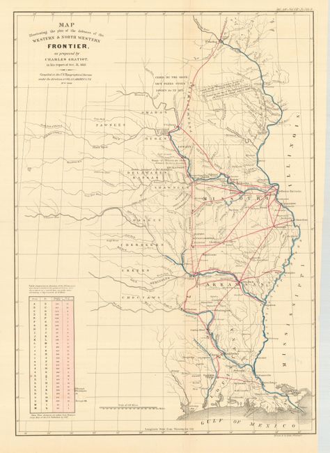
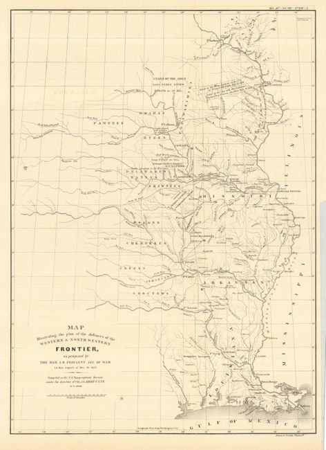
"[Lot of 2] Map Illustrating the plan of the defences of the Western & North Western Frontier…", Hood, Washington (Lt.)

Subject: Central United States

Period: 1860 (published)

Publication: American State Papers

Color: Black & White

Size:
See Description
Download High Resolution Image
(or just click on image to launch the Zoom viewer)

The American State Papers contain the legislative and executive documents of Congress during the period 1789 to 1838. During the first fourteen Congresses printing was done without guidelines resulting in a pronounced lack of information. The destruction of the Capitol in 1814 contributed greatly to this lack of Congressional documentation and eventually resulted in a bill dictating what documents would be printed for each Congress. The compilation, printing, and distribution of the Papers took place from 1831 to 1861. The American State Papers cover important historical events such as Lewis and Clark's Expedition, numerous Indian treaties, and documentation concerning America's westward expansion.

These maps are from the series of maps that illustrated the congressional debate over the nature of the frontier defenses between the Mississippi River and the Rocky Mountains. Compiled under the direction of Col. A.A. Abert by Washington Hood, the maps depict the states of Missouri, Arkansas, Louisiana and Indian nations bordering them to the west. They show the locations of many military forts and outposts from Ft. Jessup to Ft. Snelling with notations throughout concerning lands ceded by several Indian nations with dates of the treaties. The threat posed by hostile Native Americans, whose numbers greatly exceeded those of the settlers in the area, resulted in a protracted congressional debate concerning the defenses required along the frontier. These maps were initially issued in the 25 Cong. 2nd Sess. S. No. 1 Doc 65 Report, circa 1837. An important addition to any collection focusing on westward expansion.

1) Map Illustrating the plan of the defences of the Western & North Western Frontier, as proposed by Charles Gratiot, in his report of Oct. 31, 1837. Gratiot’s defense plan uses color to trace the common roads and rivers. A table at lower left notes the distances between forts and the equivalent "days of march" at 15 miles per day. (15 x 21")
2) Map Illustrating the plan of the defences of the Western & North Western Frontier, as proposed by The Hon. J. R. Poinsett Sec. of War in his report of Dec. 30, 1837. (15.4 x 21")

References: Wheat [TMW] 426 and 427.

Condition: B

Both maps in generally good, bright condition. They were issued folding, and are now flat. Map 1 has some fold separations and tears into map, repaired with archival tissue. Map 2 has a couple of spots of foxing. Both with binding trim and minor chipping in blank margins.

Estimate: $300 - $400

Sold for: $220

Closed on 3/6/2007

Archived