Catalog Archive
Auction 118, Lot 247

"A Map of the Country round Philadelphia including Part of New Jersey, New York, Staten Island & Long Island", Anon.

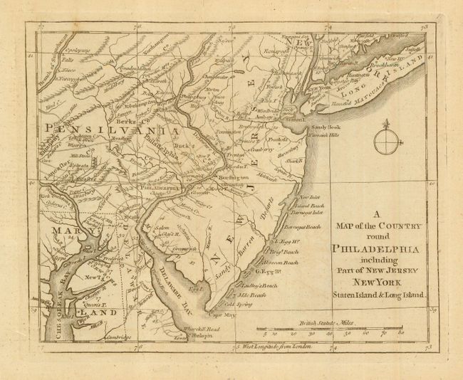
Subject: Colonial Mid-Atlantic

Period: 1776 (published)

Publication: Gentleman's Magazine

Color: Black & White

Size:
8.8 x 7 inches
22.4 x 17.8 cm
Download High Resolution Image
(or just click on image to launch the Zoom viewer)

Revolutionary War period map encompassing the area of Eastern Pennsylvania through Long Island and south to include Chesapeake Bay. The map was issued to illustrate the British Army's objective of defeating Gen. Washington at Long Island and then to march to Philadelphia and put an end to the conflict. The map is filled with interesting features including Indian villages, towns and cities, ferries, and roads (including the distances between towns). Adorned with a simple compass rose.

References: Jolly GENT-247; Phillips (M) p.699; Klein G76.6; Sellers and Van Ee 1041.

Condition: A

With folds, as issued. Nice, clean example with pleasant toning.

Estimate: $275 - $325

Sold for: $200

Closed on 3/6/2007

Archived