Catalog Archive
Auction 118, Lot 245

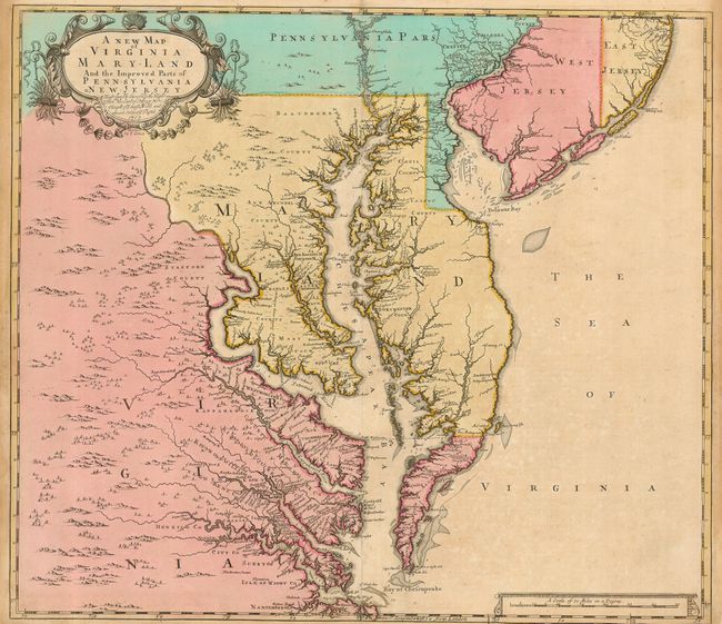
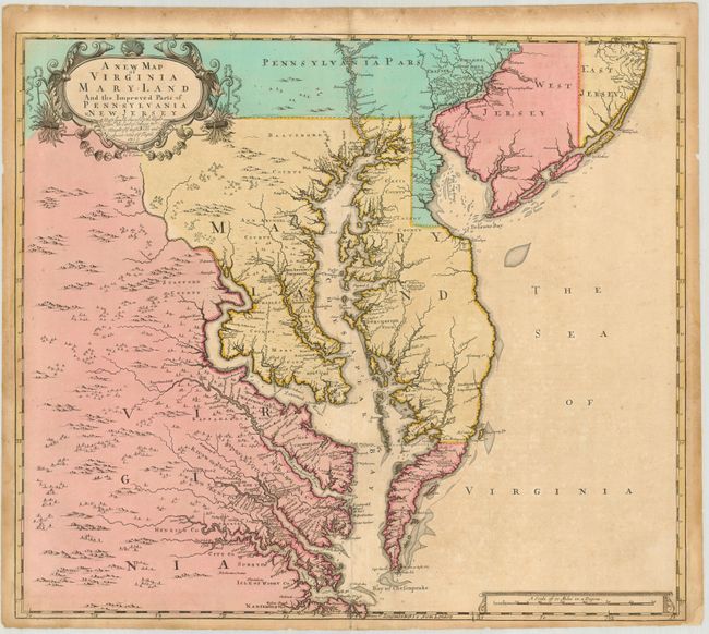
"A New Map of Virginia Mary:Land and the Improved Parts of Pennsylvania & New Jersey…", Senex, John

Subject: Colonial Mid-Atlantic

Period: 1719 (dated)

Publication: New General Atlas

Color: Hand Color

Size:
22 x 19 inches
55.9 x 48.3 cm
Download High Resolution Image
(or just click on image to launch the Zoom viewer)

This fine map of Chesapeake Bay is a derivative of the landmark map by Augustine Herrman. The map has been re-oriented with north at the top and the western region has been simplified. But the precise mapping of the bay was taken directly from the surveys of Herrman. Delaware is shown to be a part of Pennsylvania, favoring the claims of Lord Baltimore, rather than the Cape Henelopen boundary, which was finally ratified by the British courts when the dispute was settled in the 1730s. New Jersey is divided into East and West Jersey. The cartouche is festooned with tobacco, a major product of the region during colonial times.

In 1673 Augustine Herrman received a royal, fourteen year copyright on his map of Chesapeake Bay. Despite the copyright, the map was plagiarized almost immediately, first in 1676 in Speed's atlas, and many slightly modified and simplified editions followed. One of the most successful of the Herrman derivatives, in terms of longevity and beauty, was this map, first issued by Christopher Browne in 1685 and then revised by John Senex in 1719.

References: Stevens & Tree #86c.

Condition: B

Some uneven toning, darker in margins. Old paper repair on bottom centerfold separation and chipped lower right corner. Couple of marginal tears repaired with Japanese tissue. A sound map with original color.

Estimate: $2,750 - $3,500

Sold for: $4,000

Closed on 3/6/2007

Archived