Catalog Archive
Auction 118, Lot 241

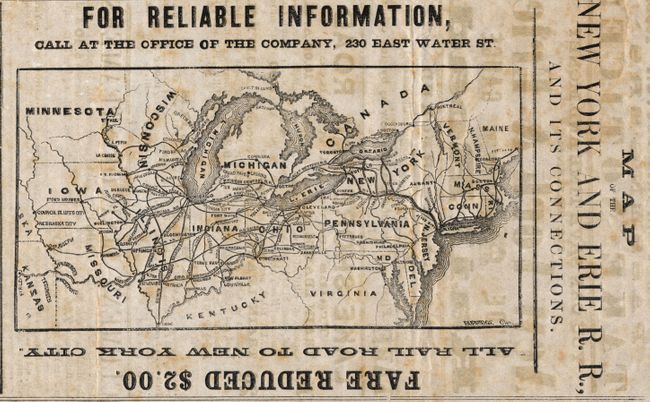
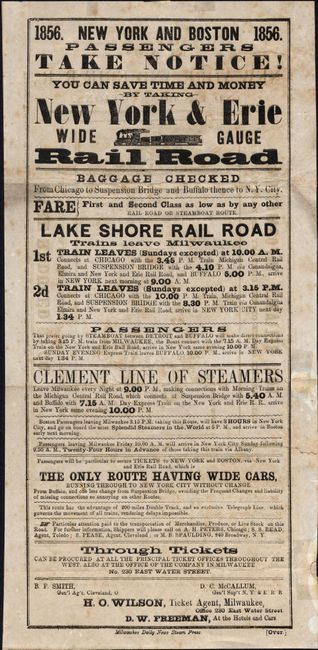
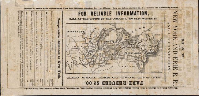
"Map of the New York and Erie R.R., and Its Connections", Railroad Companies, (Various)

Subject: United States - Northeast

Period: 1856 (dated)

Publication:

Color: Black & White

Size:
6.3 x 14.5 inches
16 x 36.8 cm
Download High Resolution Image
(or just click on image to launch the Zoom viewer)

This is a rare advertising railroad handbill of the New York & Erie Railroad. Printed on both sides, with a fine map (7.8 x 4") of the Northeast on one side. "Map of the New York and Erie R.R., and its Connections," extends as far west to show rail routes to Council Bluffs, and south to Cairo at the confluence of the Ohio and Mississippi Rivers. Below the map are comparative distances that "are taken from the American Railway guide, and can be relied upon as correct - And any statements made to the contrary by Agents of rival routes are untrue, and intended to deceive the Traveling Public." The other side has a railroad system map of the northern U.S. plus train departure times for the Lake Shore Rail Road leaving from Milwaukee and connecting steamer times and locations and their connections to various railroads. Printed by the Milwaukee Daily News Steam Press. An early advertising railroad handbill with route map printed on very thin paper. A scarce, if not unique, ephemeral railroad item.

References:

Condition: B

Dark impression on fine, thin paper with full original margins. Toned and offset. Three old repaired tears into images (closed only in blank margin), a small piece from edge filled in, and another inside blank margin. Remarkable condition for an item of this type.

Estimate: $250 - $350

Sold for: $140

Closed on 3/6/2007

Archived