Catalog Archive
Auction 118, Lot 215

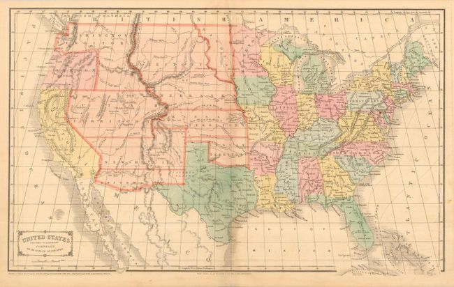
"United States", Cornell, Sarah Sophia

Subject: United States

Period: 1855 (dated)

Publication: Cornell's High School Geography

Color: Hand Color

Size:
20.5 x 12.3 inches
52.1 x 31.2 cm
Download High Resolution Image
(or just click on image to launch the Zoom viewer)

This terrific map features some of the largest western territorial boundaries. Oregon shed its eastern extents to become a state in 1859, leaving Washington in the unusual upside down "L" configuration that extends to the Rockies in the west and to Utah in the south. Utah Territory is in its largest configuration, extending to Long's Peak at the Continental Divide, with Fillmore City the capital. The oversized Kansas Territory borders Utah and New Mexico as there is no Colorado. New Mexico Territory stretches between California and Texas, but its southern region is here an early depiction of Arizona, which was proposed in Congress circa 1858. Dakota Territory is just a sliver between Minnesota and the Missouri River, which it shares as a boundary with a huge Nebraska Territory, extending north to the Canadian border and west to the Continental Divide in the Rocky Mountains. The map is dated 1855, but published with updates circa 1860-61 based on territorial boundaries. Published by D. Appleton & Company.

References:

Condition: B

Original coloring and margins. Some very light scattered offsetting or foxing, else near fine.

Estimate: $150 - $200

Sold for: $140

Closed on 3/6/2007

Archived