Catalog Archive
Auction 118, Lot 205

"Partie Orientale de la Nouvelle France ou du Canada", Homann Heirs

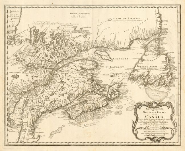
Subject: Colonial United States and Canada

Period: 1755 (dated)

Publication:

Color: Black & White

Size:
21.3 x 17 inches
54.1 x 43.2 cm
Download High Resolution Image
(or just click on image to launch the Zoom viewer)

This is the Homann edition of Bellin's definitive map of eastern Canada and New England showing the mouth of the St. Lawrence, the length of the river, the Maritime provinces and French claims in the region. There are some very interesting details of the coastal towns, showing Havre de Baston for Boston Harbor, up the coast to Portsmouth in New Hampshire, Wells, York and Cape Elizabeth in Maine. There is considerable information shown on the extent of French exploration in the region. The map was copied from the first state of Bellin's map of the same title (1745) retaining the crude shape for Cape Cod.

References: Kershaw #690; McCorkle #745.1.

Condition: A

Very nice impression printed on fine, strong paper with a couple of damp stains in the blank margins, well away from map.

Estimate: $475 - $550

Sold for: $350

Closed on 3/6/2007

Archived