Catalog Archive
Auction 118, Lot 198

"[Canada]", Mueller/Bodenehr

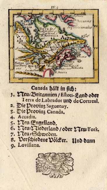
Subject: Colonial United States and Canada, Great Lakes

Period: 1692 (published)

Publication: Kurtze-bundige abbild-und vorftellung de gantzenwelt

Color: Hand Color

Size:
3 x 2.5 inches
7.6 x 6.4 cm
Download High Resolution Image
(or just click on image to launch the Zoom viewer)

This rare, tiny map is a German version of Pierre Duval's map, which in turn was derived from Sanson's influential Le Canada ou Nouvelle France of 1656. The map is centered on the French possessions in North America with emphasis on the Great Lakes. Lake Superior and Michigan (Lac des puants) are shown with open-ended western shores and Lake Erie (Lac du Chat) is located too far south. The British, Dutch and Swedish colonies are depicted along the eastern seaboard from Virginia to I. de Terre Neuve. A key in German text is below the map.

References: Kershaw #143; King (2nd ed.) pp.160-61.

Condition: A+

Estimate: $350 - $400

Sold for: $300

Closed on 3/6/2007

Archived