Catalog Archive
Auction 118, Lot 172

"A Chart of Hudson's Straits and Bay, According to the Discoveries made between the Years 1610 & 1743", Swaine Drage, Charles

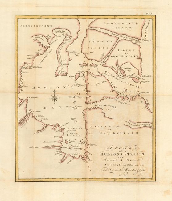
Subject: Canada - Hudson Bay

Period: 1749 (published)

Publication: An Account of a Voyage for Discovery of a North-West Passage by Hudson's Streigh

Color: Hand Color

Size:
11.5 x 13.4 inches
29.2 x 34 cm
Download High Resolution Image
(or just click on image to launch the Zoom viewer)

This is the first edition of this scarce map of Hudson Bay by Charles Swaine Drage, who was the clerk on the same expedition as Henry Ellis in 1746. The map shows an odd triple island configuration with James' Island, Cumberland Island and the Island of Good Fortune. Wager Bay inlet is shown open-ended. The map shows the various discoveries that had been made in the region prior to the Ellis exploration. Decorated with an unusual, anthropomorphic compass rose.

References: Kershaw #430.

Condition: B

Generally good with some toning and a couple tiny fold separations. Hinge remnants at top margin.

Estimate: $150 - $200

Sold for: $110

Closed on 3/6/2007

Archived