Catalog Archive
Auction 118, Lot 16

"Orbis Terrae Compendiosa Descriptio…", Mercator, Rumold
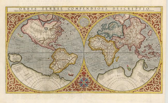
Subject: World

Period: 1587 (dated)

Publication: Atlas Sive Cosmographicae Meditationes de Fabrica…

Color: Hand Color

Size:
20.5 x 11.3 inches
52.1 x 28.7 cm
Download High Resolution Image
(or just click on image to launch the Zoom viewer)

This beautiful double hemisphere map is surrounded in an elaborate strapwork border with an armillary sphere and a 32-point compass rose tucked between the hemispheres. Rumold Mercator based this map on his father's great world map of 1569. The North Pole is depicted as a landmass surrounding a sea from which four rivers radiate and there is a well depicted Northwest Passage. In the Antarctic is the imaginary southern continent and there is a bulge in the southwest coast of South America. The map embodies many ancient authorities and is a wonderful view of classical cartography. Cracks in the copper plate are barely visible in the title, indicating a later publication circa 1613. French text on verso.

References: Shirley #157.

Condition: A

Tissue repairs on centerfold with a couple extraneous creases, else very good.

Estimate: $5,500 - $6,500

Sold for: $4,000

Closed on 3/6/2007

Archived