Catalog Archive
Auction 118, Lot 159

"Estotilandia et Laboratoris Terra", Metellus, Natalius Sequanus

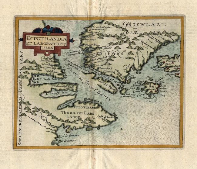
Subject: Canada and Greenland

Period: 1600 (published)

Publication: America sive novus orbis

Color: Hand Color

Size:
9 x 7.1 inches
22.9 x 18 cm
Download High Resolution Image
(or just click on image to launch the Zoom viewer)

This very rare map is a slightly reduced version of Cornelis Wytfliet's map of the same title (1597). It is an important and influential cartographic depiction of one of the first detailed records of the discoveries of Davis and Frobisher in their search for the Northwest Passage. It is centered on the Davis Strait and depicts much of Greenland, Labrador, Iceland as well as the mythical island of Frisland. While both Frisland and Estotiland appeared on Mercator’s 1569 map, this is one of the first maps to focus specifically on these locations. Frisland is remarkably detailed, with many settlements clearly noted. Other interesting features include the mysterious R. de Tormenta and "a furious over fall" emptying into the Davis Strait, which is an early indication of Hudson Strait, and is thought to have inspired Hudson in his search for a Northwest Passage at this location. Latin text on verso.

References: Burden #116; Kershaw #43.

Condition: B

Crisp impression and handsome color. Hinge remnants at the top. There is a repair of worm tracks on the centerfold, with a little facsimile.

Estimate: $800 - $1,000

Sold for: $750

Closed on 3/6/2007

Archived