Catalog Archive
Auction 118, Lot 137

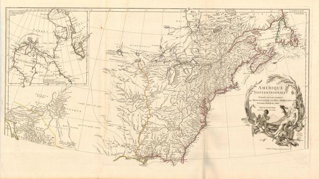
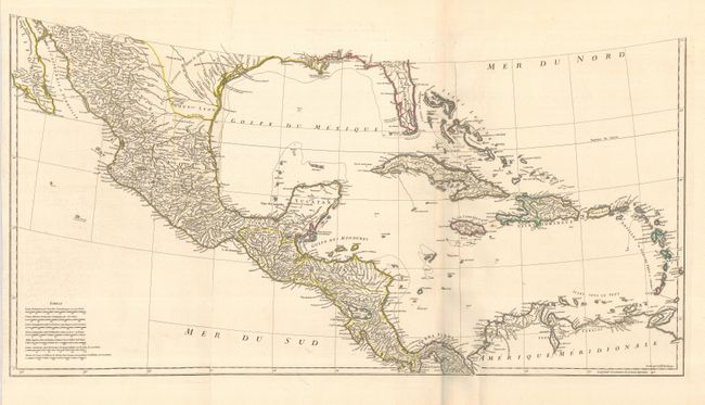
"Amerique Septentrionale Publiee sous les Auspices de Monseigneur le Duc d'Orleans Premier Prince du Sang", Anville, Jean Baptiste Bourguignon d'

Subject: Colonial North America and West Indies

Period: 1746 (dated)

Publication:

Color: Hand Color

Size:
34 x 17 inches
86.4 x 43.2 cm
Download High Resolution Image
(or just click on image to launch the Zoom viewer)

First state of this striking map of North America and the West Indies. It is one of the best French maps of North America prior to the French & Indian War. D'Anville was the Royal Geographer and Cartographer to the King of France. He followed Delisle as the chief proponent of scientific cartography, and his influence on his contemporaries was profound. Because he had direct access to the many official French records of North America his maps are known for their excellent detail and clearly presented information. The map provides good information in New Mexico and the Mississippi and Missouri river valleys. A remnant of Lahontan's fabled Grande Rivier is retained west of Lac du Bois. The region of the Ohio River Valley and below the Great Lakes reflects the superior knowledge of the French in these regions. The newly formed colony of Georgia appears squeezed between South Carolina and the Spanish claims to Florida. The map names Tecas and includes a notation on the Texas coast concerning Port Francois referring to La Harpe's expedition. Many place names, Indian tribes, and forts are located. At upper left is an inset of Hudson and Baffin Bays. Map engraved by Guillame Delahaye, decorative cartouche drawn by Graevlot and engraved by Major. Printed on 4 sheets of heavy paper, now joined into 2 sheets as commonly issued. The overall image height would be 33" if the parts were joined for framing.

Tooley held D'Anville's cartography in such high esteem that he stated, "to illustrate the [North American] cartography of the second half of the eighteenth century, a D'Anville map is essential … His representation of the Great Lakes is superior to that of his contemporary John Mitchell."

References: Karpinski (MI) p. 138; Lowery #381; Tooley (Am) pp. 316-17.

Condition: A

This is a fine example of this huge map with a great impression printed on quality paper with wide margins and original outline color. There is a bit of light soil and a rust spot on the upper sheet, else very fine.

Estimate: $1,600 - $2,000

Unsold

Closed on 3/6/2007

Archived