Catalog Archive
Auction 118, Lot 123

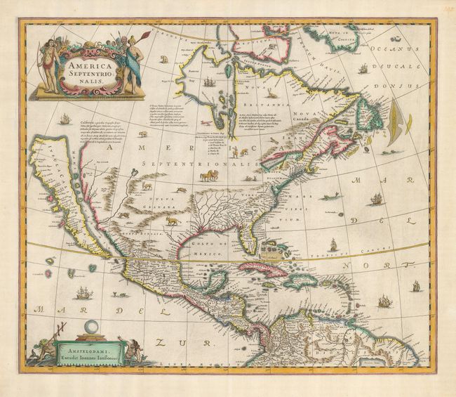
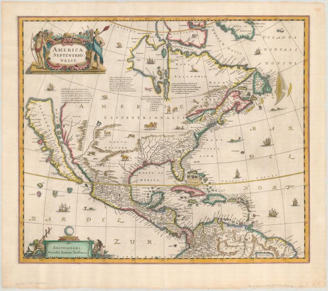
"America Septentrionalis", Hondius/Jansson

Subject: North America

Period: 1641 (circa)

Publication: Atlas Novus

Color: Hand Color

Size:
21.3 x 18 inches
54.1 x 45.7 cm
Download High Resolution Image
(or just click on image to launch the Zoom viewer)

This stunning, important map of North America had great influence in perpetuating the theory of California as an island due to its wide distribution through this preeminent Dutch publishing firm. The map is a careful compilation of various sources and represents the current state of cartographic knowledge at the time. The insular California is derived directly from Henry Briggs, as is the depiction of the Arctic. The island of California is shown with a great number of place names, including po. de S. Diego (San Diego) and Po. Sir Francisco Draco (San Francisco). The Rio del Nort originates in a large western lake and flows incorrectly into the Mare Vermio. The cartography of the Gulf of Mexico and Florida is based on Hessel Gerritsz. On the east coast the region identified as Novum Belgium is greatly elongated, Iames Towne and a few place names from John Smith's map appear in Nova Anglia. There is a single Lac des Iroquois in the Great Lakes region. The map is richly embellished with a variety of animals throughout the interior, including deer, horses, buffalo, rabbits and more. The oceans are teeming with ships and sea monsters. The title cartouche features several Native Americans and the imprint cartouche features two comely mermaids. Second state of this fine map, with Jansson's imprint and a blank verso.

References: Burden #245; McLaughlin #6; Tooley (America), pl. 28, Goss (NA) #30.

Condition: A

The map is bright and clean with later color with a bit of bleed-through on the verso. The blank margins have some short tears and a little chipping with professional repairs.

Estimate: $5,000 - $6,000

Sold for: $3,250

Closed on 3/6/2007

Archived