Catalog Archive
Auction 117, Lot 9

"Carta Marina Nuova Tavola", Ruscelli, Girolamo
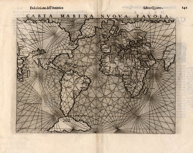
Subject: World

Period: 1562 (circa)

Publication:

Color: Black & White

Size:
9.5 x 7.3 inches
24.1 x 18.5 cm
Download High Resolution Image
(or just click on image to launch the Zoom viewer)

Ruscelli's mariner's map is based on Gastaldi's map of 1548. The landmasses are shown with little interior detail but with a fair number of coastal place names. The North American continent is most interesting with the northwestern coastline extending to join Asia. The continent is nearly divided by a large inland sea. In the Northeast the Montagna Verde appears just below an isthmus that connects to Greenland and then onto Scandinavia. Below South America is the huge island of Tierra del Fuego. Loxodromic lines crisscross the map radiating from sixteen focal points and the sea is stipple engraved. Italian text on verso.

References: Shirley #111.

Condition: A

Light damp stains in blank margins, not affecting map.

Estimate: $900 - $1,100

Sold for: $900

Closed on 12/6/2006

Archived