Catalog Archive
Auction 117, Lot 97

"Conibas Regio cum Vicinis Gentibus", Metellus, Natalius Sequanus
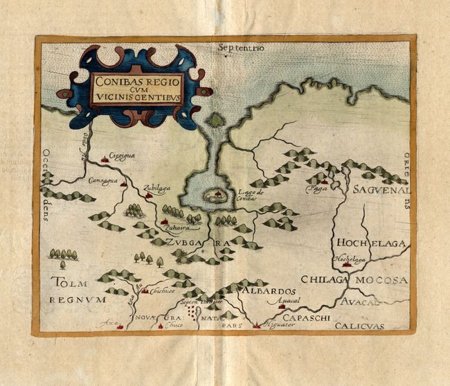
Subject: Canada

Period: 1600 (published)

Publication: America sive novus orbis

Color: Hand Color

Size:
8.5 x 6.6 inches
21.6 x 16.8 cm
Download High Resolution Image
(or just click on image to launch the Zoom viewer)

This intriguing map is a slightly reduced version of Cornelis Wytfliet's 1597 map of the same title. It is one of the earliest maps to focus on the central region of Canada and it is one of the earliest descriptions of the Native American settlement of Hochelaga, which would become Montreal. The Lago de Conibas is considered to be a very early description of James - Hudson Bay. A cluster of cities labeled Septem Civitates is located in the lower portion of the map, a reference to the fabled Seven Cities of Cibola.

References: Kershaw #42; Burden #115.

Condition: B

Generally good with a professional repair of some worming in the centerfold, with a little bit of facsimile. Hinge remnants and two short tears in top, blank margin.

Estimate: $700 - $1,000

Sold for: $500

Closed on 12/6/2006

Archived