Catalog Archive
Auction 117, Lot 95

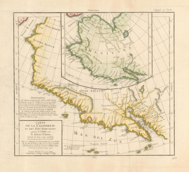
"Carte de la Californie et des Pays Nord-Ouest separes de l'Asie par le Detroit d'Anian, extraite de deux cartes publiees au commencement du 17e siecle", Robert de Vaugondy, Didier

Subject: Western North America

Period: 1772 (dated)

Publication: Diderot's Encyclopedie

Color: Hand Color

Size:
12.8 x 11.8 inches
32.5 x 30 cm
Download High Resolution Image
(or just click on image to launch the Zoom viewer)

Two maps, one inset into the other. The inset map is based on a world map by Plancius issued in 1641, while the larger map is based on Visscher's map of 1612. Other than a recognizable Baja California, the maps are filled with the cartographic myths of the 17th century. The northwest coast bulges too far to the west. Both maps feature the seven cities of Cibola.

References: Wheat (TMW) #159; Wagner (NW) #632; Pedley #473.

Condition: A

Issued folding, now pressed.

Estimate: $275 - $350

Sold for: $200

Closed on 12/6/2006

Archived