Catalog Archive
Auction 117, Lot 799

"Tabula Prima de Libya Quale et Aphrica", Ptolemy/Berlinghieri

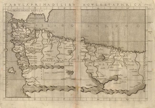
Subject: Northern Africa

Period: 1482 (published)

Publication: Septe Giornate della Geographia di Francesco Berlinghieri

Color: Black & White

Size:
18 x 12 inches
45.7 x 30.5 cm
Download High Resolution Image
(or just click on image to launch the Zoom viewer)

This is a rare and very early copper plate engraving of northwestern Africa showing the regions that would become Morocco and Algeria and showing the southern coast of Spain and the Straits of Gibraltar. Berlinghieri's maps are the ones based on Ptolemy to be drawn on the original projection, with equidistant meridians and parallels. Berlinghieri paraphrased Ptolemy in Italian terza rima(a poetic form ), making this from the first atlas in vernacular Italian. It is beautifully engraved with stippled seas and a unique depiction of the mountain ranges. It has been argued among map historians that the plates were engraved by Francesco Rosselli.

References: Mickwitz & Miekkavaara, (Nordenskiold Vol. 2) #198:13; Imago Mundi, Vol. 56, No. 2, pp. 152-169.

Condition: A

Striking, dark impression with a bit of minor toning on centerfold; overall very good for a map of this period.

Estimate: $3,750 - $4,500

Sold for: $2,000

Closed on 12/6/2006

Archived