Catalog Archive
Auction 117, Lot 765

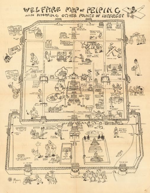
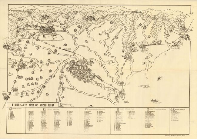
"[Lot of 2] Welfare Map of Peiping Also Showing Other Points of Interest [and] A Bird's Eye View of North China",

Subject: China

Period: 1910-1920 (circa)

Publication:

Color: Black & White

Size:
See Description
Download High Resolution Image
(or just click on image to launch the Zoom viewer)

A great pair of ephemeral tourist maps. The first is a bird's-eye view of the walled city of Peking showing buildings, palaces and numerous cartoon vignettes - many humorous from today's perspective. The Methodist Bean Milk Station is illustrated with a fellow with a bowl, and "Safety First" Horse-shoeing shows an angry horse trussed up where he can't kick, to mention a few. Also locates the Shopping District with Lantern, Jade and Embroidery Streets, the Temple and Altar of Heaven, Polo Field, the road to the Hill-Murray School for the Blind, and much more. Also shows the regions in the city: Imperial City, Tartar City, and Chinese City. The inner walled Forbidden City lays next to the Winter Palace grounds. Drawn by Atterbury. (16.5 x 20.3")
The second map was published in the Peiping Chronicle. Extensive index below the map is divided into Important Cities, Ordinary Hsien Cities, Towns with Railway Stations, Famous Historical Places, Special Topographical Details, and the Mining Districts, all indicated with phonetic English. All together 160 places are indexed and located on the map. The view shows boats and ships entering Tientsin, with trains running between the cities, but no sign of autos. (29.8 x 20") A rare pair of early maps evidently targeted at the tourist and perhaps the expatriate community.

References:

Condition: A

Both folding, as issued. The first has light toning at two folds. The second is near fine.

Estimate: $120 - $180

Sold for: $210

Closed on 12/6/2006

Archived