Catalog Archive
Auction 117, Lot 492

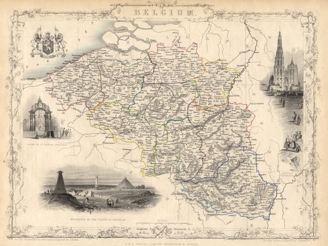
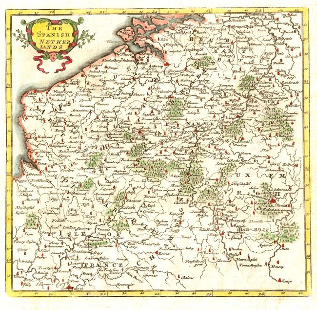
"[Lot of 2] Belgium [together with] The Spanish Netherlands",

Subject: Belgium

Period: 1735-1850 (circa)

Publication:

Color: Hand Color

Size:
See Description
Download High Resolution Image
(or just click on image to launch the Zoom viewer)

Nice pair of decorative maps of Belgium that span the 18th and 19th centuries.

1) Belgium is a decorative and finely engraved map with vignettes of the Antwerp Cathedral, Monuments on the Plains of Waterloo, Altar of St. Gudule, Brussels, and the royal coat of arms flanked by two ferocious lions. There is nice detail of roads, canals, and towns. Surrounded by a delicately engraved and decorative border by J. Marchant and J. B. Allen, who also did the vignettes. The map was engraved by J. Rapkin, and published by John Tallis, circa 1850. (13 x 9.7")
2) The Spanish Netherlands is a wonderful, small map by Herman Moll, circa 1735 showing Belgium with Calais on the coast across to Limbourg in the east. Paris is at the southernmost point of the map, which is roughly centered on Namur. The map is adorned with a delicate floral cartouche. (Map is 7.3 x 7" on a sheet 8 x 12")

References:

Condition: A

1) Very good with minor toning at edges. Original outline color.<br> 2) Tiny spot on blank margin and a bit of hinge tape on verso.

Estimate: $180 - $220

Unsold

Closed on 12/6/2006

Archived