Catalog Archive
Auction 117, Lot 430

"Carte du Nord Est &c du Nord West du Pole", Bernard, Jean Frederic
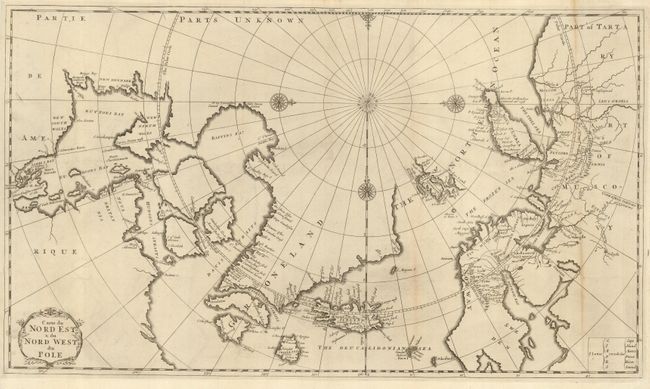
Subject: Arctic

Period: 1717 (published)

Publication:

Color: Black & White

Size:
22.5 x 13 inches
57.2 x 33 cm
Download High Resolution Image
(or just click on image to launch the Zoom viewer)

Copper engraved map of the Arctic showing the three-island version of Greenland, and Nova Zembla as an island. The mythical island of Freesland, with several place names, is shown off the southwest coast of Greenland. This map is derived from Moses Pitt's map of the Arctic that was reduced by Robinson in 1694. First published in his Recueil de Voyages au Nord 1717, this example in the second state; mentioned by Kershaw as probably from Isaac de la Peyrère’s history of Greenland. Two place names in Iceland, Papei and Sneland, also suggest a relation with a map by Pierre Duval that accompanied La Peyrère’s book about Iceland. Embellished with four compass roses and a title cartouche.

References: Kershaw #123.

Condition: B

Nice, sharp impression with some toning of the folds and a tiny spot of loss in an unengraved portion. Professionally backed with Japanese tissue. Hinge remnants on verso.

Estimate: $300 - $400

Sold for: $220

Closed on 12/6/2006

Archived