Catalog Archive
Auction 117, Lot 372

"An Accurate Map of the West Indies. Drawn from the Best Authorities, Assisted by the Most Approved Modern Maps and Charts, and Regulated by Astronomical Observations", Bowen, Emanuel

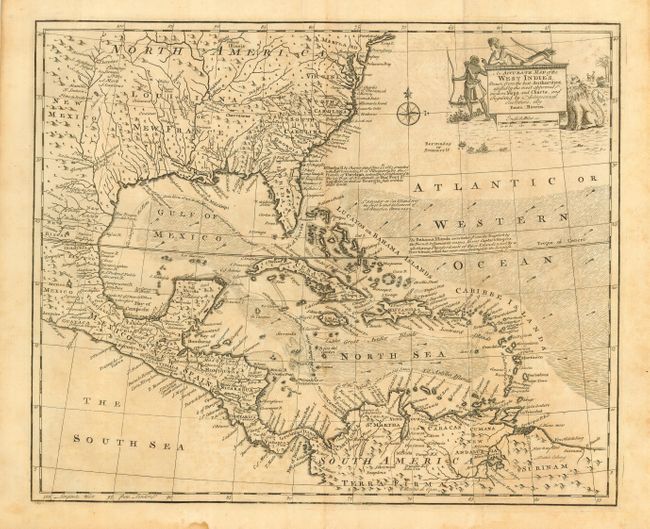
Subject: Gulf of Mexico and Caribbean

Period: 1747 (published)

Publication: A Complete System of Geography

Color: Black & White

Size:
16.5 x 13.5 inches
41.9 x 34.3 cm
Download High Resolution Image
(or just click on image to launch the Zoom viewer)

This is an attractive copper engraved map covering the southeastern United States, eastern Mexico, Central America and the West Indies. The map is derived from Popple's important map of the region. The British colonies are confined east of the Appalachians with France in control of Louisiana. Many early forts and Indian tribal territories are located. There are several interesting notations concerning the history of the region, e.g., "K. Charles II by Charter dated June 30th 1665 granted the E. of Caredon, D. of Albermarle, &c. the Province of Carolina, extending Southward to the 20 Deg. of N. Latitude so that Fort St. Augustin as well as Georgia falls within these limits." Trade winds and sea routes are marked throughout, including the course of the Spanish gold fleet from Old Spain and the return trip from Cartagena and Vera Cruz. The title cartouche is adorned with Native Americans and an incongruous lion (likely representing the British colonies). This is the first edition with No. 68 in bottom left margin.

References: Sellers & Van Ee #1682.

Condition: B

Good impression with some uneven toning and minor offsetting

Estimate: $400 - $500

Sold for: $325

Closed on 12/6/2006

Archived