Catalog Archive
Auction 117, Lot 370

"Map of Central America Shewing the Different Lines of Atlantic & Pacific Communication", Wyld, James

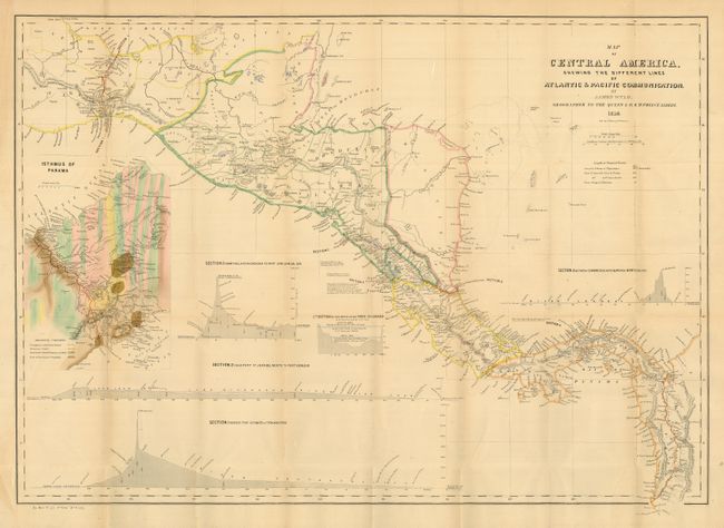
Subject: Central America

Period: 1850 (dated)

Publication: HR doc 75, 31st Cong. 1st Sess.

Color: Hand Color

Size:
32 x 22.5 inches
81.3 x 57.2 cm
Download High Resolution Image
(or just click on image to launch the Zoom viewer)

A most unusual U.S. Government edition of this handsome map of Central America executed by Englishman James Wyld and published in a report to Congress. At the time, there was great interest in Central America as the site for a land transit that would cut weeks off a journey to California and the gold fields. The map shows four sections: Across the Isthmus of Tehuantepec; from Port Sn. Juan del Norte to Port Realejo; between Charges (Atlantic) &c Vaca de Monte (Pacific); and from the Lake Nicaragua to Port San Juna del Sur. A large and very colorful inset shows the Isthmus of Panama and the planned route in great detail. Printed on much heavier paper than the typical government document.

References:

Condition: A

Folding as issued. Very handsome full original hand coloring.

Estimate: $160 - $200

Sold for: $220

Closed on 12/6/2006

Archived