Catalog Archive
Auction 117, Lot 332

"Map of Texas and Parts of Adjoining Territories", U.S. Geological Survey (USGS)
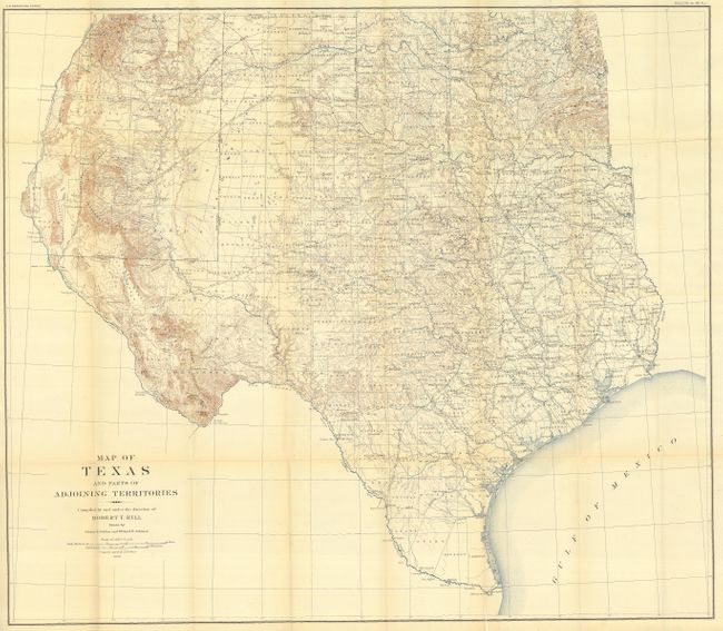
Subject: Texas

Period: 1899 (dated)

Publication: A Gazetteer of Texas

Color: Printed Color

Size:
35.5 x 31 inches
90.2 x 78.7 cm
Download High Resolution Image
(or just click on image to launch the Zoom viewer)

A large and extremely detailed map of the state that also covers most of Oklahoma and New Mexico east of the Rio Grande and south of Taos. The details include counties, county seats, railroads, topographical and watershed with contours at 250' intervals. This map, by Robert T. Hill, a widely known scholar, teacher and geologist, brought new sophistication to Texas cartography and helped set new scientific standards for the region's cartography. It was also published in Topographical Atlas of the U.S., Physical geography of the Texas Region. Lovely example.

References: Martin & Martin, plt 50.

Condition: A

Folding, as issued. Near mint example.

Estimate: $400 - $500

Sold for: $300

Closed on 12/6/2006

Archived