Catalog Archive
Auction 117, Lot 304

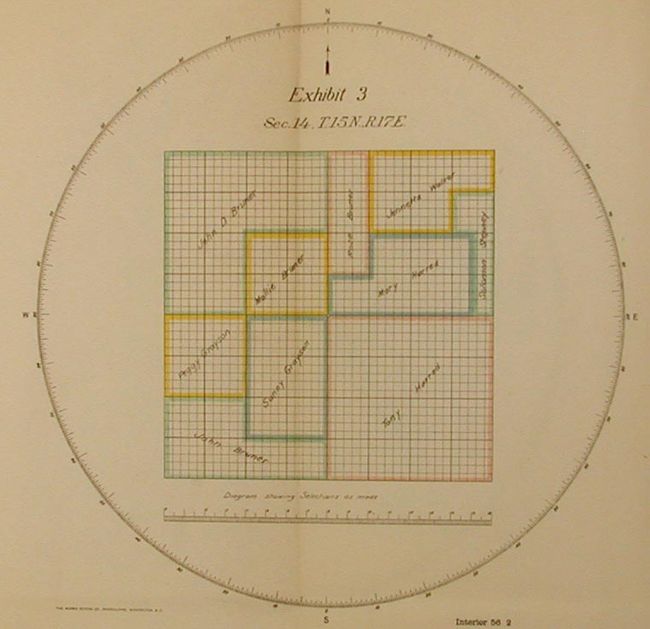
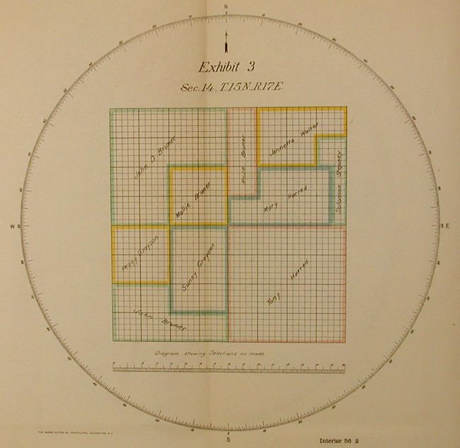
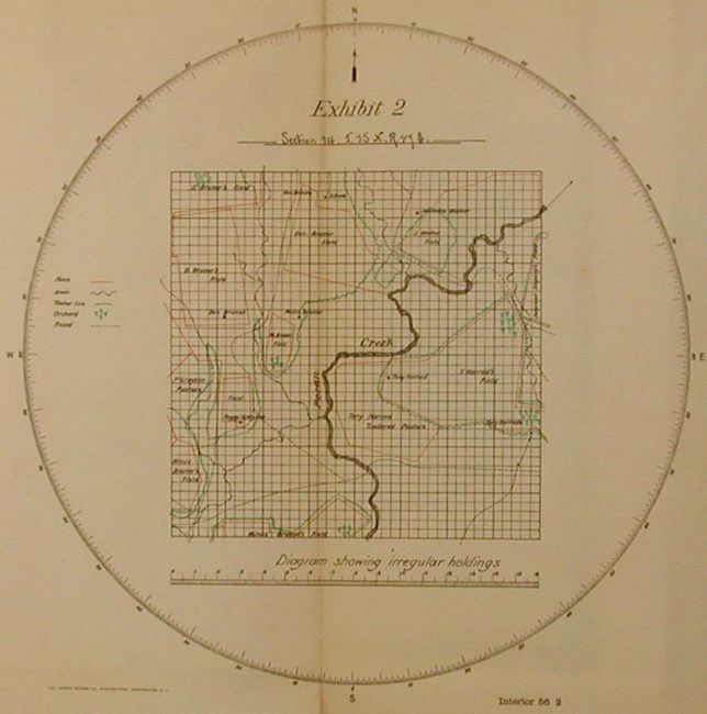
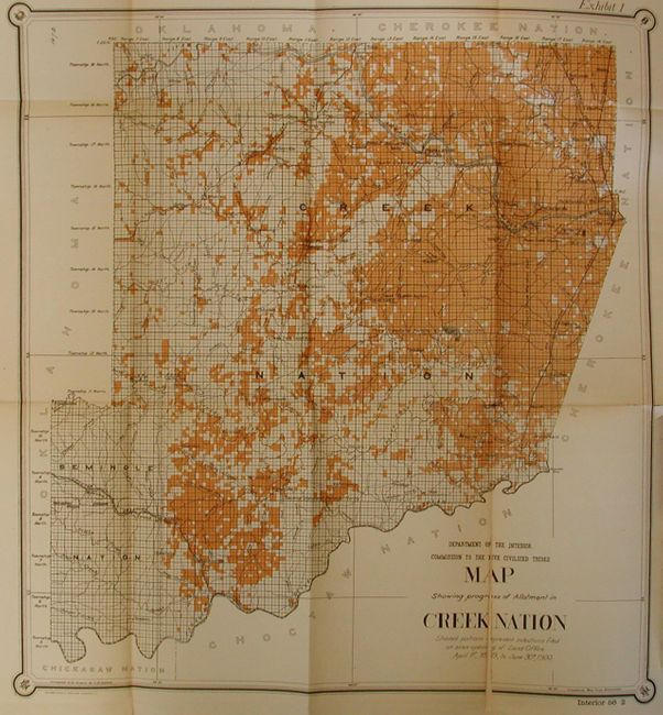
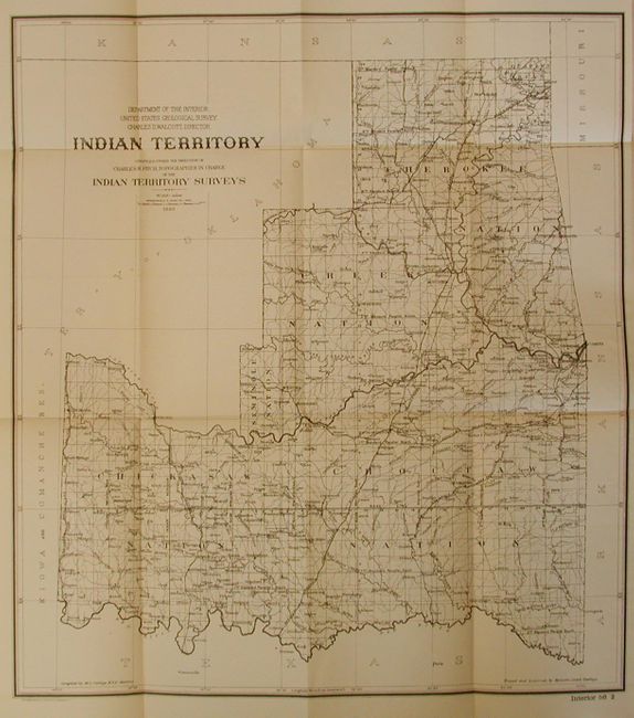
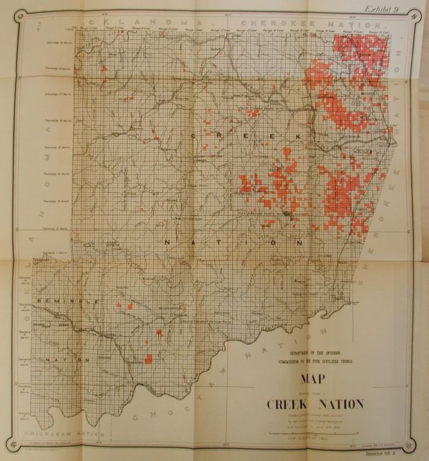
"Seventh Annual Report of the Commission to the Five Civilized Tribes to the Secretary of the Interior for the Fiscal Year Ended June 30, 1900", U.S. Gov't Printing Office

Subject: Oklahoma

Period: 1900 (dated)

Publication: Seventh Annual Report of the Commission to the Five Civilized Tribes

Color: Black & White

Size:
6 x 9 inches
15.2 x 22.9 cm
Download High Resolution Image
(or just click on image to launch the Zoom viewer)

Interesting, historical document regarding the process of the creation of the Dawes Rolls of Native American Indians in Indian Territory and Oklahoma and their lands. The years after the Civil War had seen many other tribes and emigrants move into the territory and the Commission to the Five Civilized Tribes was created in 1893 to sort out and divide the land between tribes and Freedmen, who were the African-American descendants of slaves who were freed after the Civil War. The text recounts how the lands were re-divided and allotted and includes information on the allotment of land to the Five Civilized Tribes of Choctaw, Creek, Chickasaw, Cherokee and Seminole and Freedmen. The document has 10 maps and diagrams. All contained in paper booklet with title page, contents, 76 pp, 10 maps. An important group of documents related to the Indian Territory:

1) Map showing the progress of allotment in the Creek Nation.
2) Diagram showing irregular holdings prior to preliminary allotment.
3) Diagram showing same section after adjustment by commission.
4) Map showing the progress of surveys (Creek Nation).
5) Map showing the progress of appraisement in Chocktaw Nation.
6) Map showing the progress of appraisement in Chickasaw Nation.
7) Specimen page from record showing classification of lands.
8) Specimen page from record showing method of platting allowances.
9) Map showing lands covered by grazing leases in Creek Nation.
10) Map of Indian Territory.

References:

Condition: B

Booklet covers loose from front of spine, worn and with tape reinforcement at corners. Owner's stamp on title page at upper right not affecting text. Most of the maps have some fold splits and one is cleanly detached along binding side.

Estimate: $250 - $300

Sold for: $160

Closed on 12/6/2006

Archived