Catalog Archive
Auction 117, Lot 303

"Map of Chickasaw Nation Indian Territory", U.S. Geological Survey (USGS)
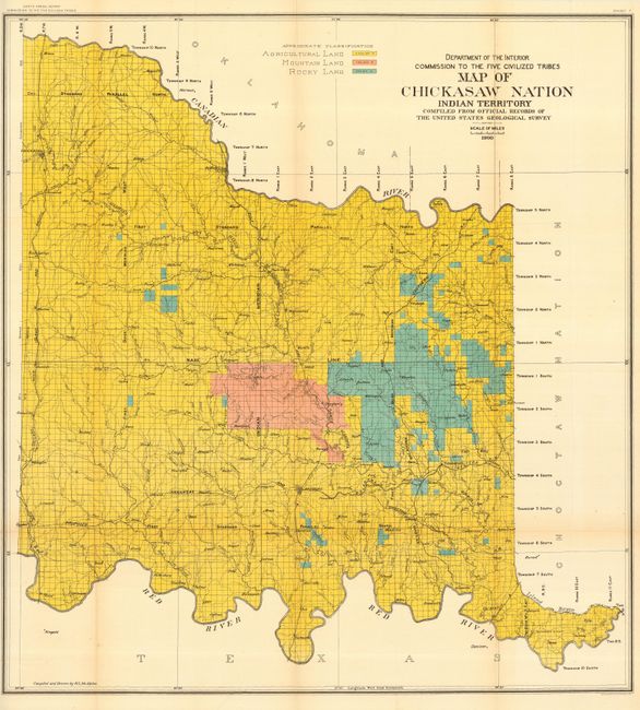
Subject: Oklahoma

Period: 1900 (dated)

Publication: Commission to the Five Civilized Tribes

Color: Printed Color

Size:
30.5 x 33 inches
77.5 x 83.8 cm
Download High Resolution Image
(or just click on image to launch the Zoom viewer)

This large, bold map shows the land allotments for the Chickasaw Nation in the region between the Canadian and Red Rivers. Color designates agricultural, mountain and rocky lands. The Commission to the Five Civilized Tribes was appointed to negotiate with the Five Tribes for the extinguishment of their tribal title to lands by allotment, and division of the same among the members of the tribes. This commission became known as the Dawes Commission, after Senator Henry L. Dawes, who was largely responsible for the legislation. Their main task was to make an equitable division of nearly twenty million acres of land among more that 100,000 Indians. In 1895 the USGS began to conduct surveys of all lands in Indian Territory into townships, ranges and sections. These maps were used by the Dawes Commission to assist the citizens on the tribal rolls to select their individual plats of land.

References:

Condition: A

Folding as issued.

Estimate: $160 - $200

Sold for: $120

Closed on 12/6/2006

Archived