Catalog Archive
Auction 117, Lot 302

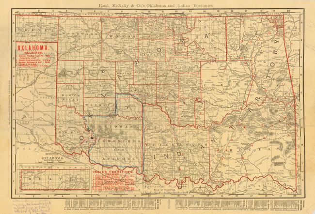
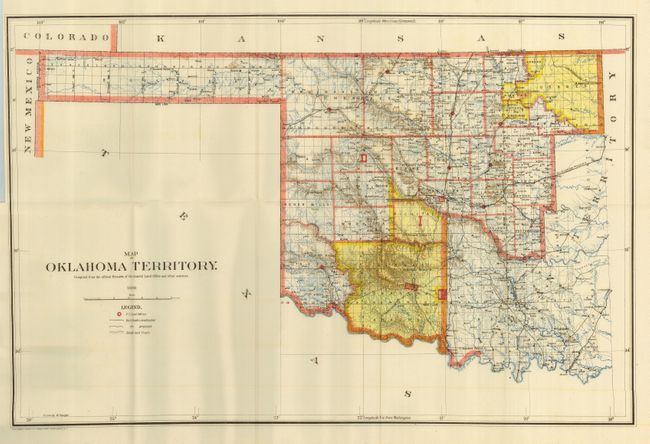
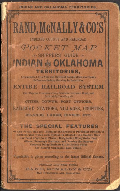
"[Lot of 2] Rand, McNally & Co.'s Oklahoma and Indian Territories [and] Map of Oklahoma Territory. Compiled from the Official Records of the General Land Office and Other Sources",

Subject: Oklahoma

Period: 1898 (dated)

Publication:

Color: Printed Color

Size:
See Description
Download High Resolution Image
(or just click on image to launch the Zoom viewer)

Nice pair of maps both published in 1898. The first is colored in outline to delineate counties and to show twelve railroads listed in red overprinting. The extreme western portion of Beaver County is in an inset at lower left. Hand-written marginal note states that the location of Altus is not accurate. Writer also outlines an area in blue pencil. Folds into stiff paper wrappers, including title pages and railroad index for each territory. (18 x 13.5")
The second folding map is a fine example of the 1898 General Land Office issue that accurately shows the location of Altus. This map shows U.S. Land offices, railroads constructed and those proposed, plus roads and trails throughout the territory. (18.8 x 13.5")

References:

Condition: A

The first has worn wrappers and a short tear at binding trim in blank margin.

Estimate: $120 - $150

Sold for: $75

Closed on 12/6/2006

Archived