Catalog Archive
Auction 117, Lot 296

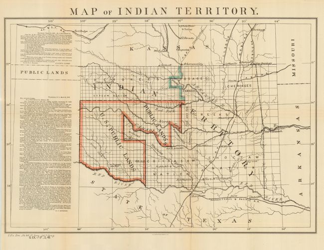
"Map of Indian Territory", Boudinot, E. C.

Subject: Oklahoma

Period: 1879 (dated)

Publication: Sen Ex Doc No. 50, 48th Cong., 2nd Sess [and] Doc 20 46th Cong., 1st Sess

Color: Printed Color

Size:
22 x 15 inches
55.9 x 38.1 cm
Download High Resolution Image
(or just click on image to launch the Zoom viewer)

A desirable map depicting the territory with the first designation of Public Lands. Included in a panel to the side of the map are two fascinating letters concerning the disposition of the Public Lands within the territory. The first, by Congressman Augustus Albert contains a list of questions. The answers, by Col. E.C. Boudinot, attempts to "set the records straight" by detailing how the land was acquired from the Indians, its current status, and directions to "several million acres of the richest land on the continent." A number of Army forts are named and located. A significant and important map for any Oklahoma collection.

References:

Condition: A

Near fine example with dark impression, fine color and full margins. Slightest trace of fold toning, else fine.

Estimate: $200 - $250

Sold for: $150

Closed on 12/6/2006

Archived