Catalog Archive
Auction 117, Lot 293

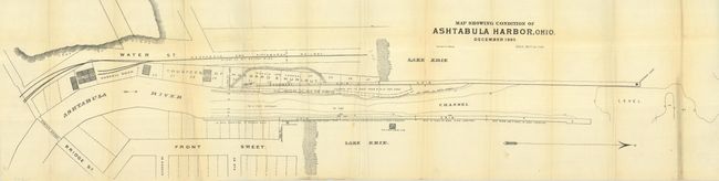
"Map Showing Condition of Ashtabula Harbor, Ohio. December 1885",

Subject: Ohio

Period: 1885 (dated)

Publication:

Color: Black & White

Size:
36.5 x 9 inches
92.7 x 22.9 cm
Download High Resolution Image
(or just click on image to launch the Zoom viewer)

This plan details Ashtabula Harbor and the condition of breakwaters and other structures along the river with comments such as "built 16 years or more, in bad condition" and "washed into channel." The map details the last 3,100 feet of the river from the pontoon bridge at Bridge Street to its mouth on Lake Erie. It extends to show several streets plus the Ashtabula River and the lines for the Ashtabula and Pittsburgh Railway. Locates the Haskell Dock, shows depths in various portions of the channel, etc. Printed by Otto Krebs Lith., Pittsburg. Drawn on a scale of 100 ft. to the inch. An uncommon chart.

Just three miles inland from this map occurred the worst train disaster in U.S. history. On a cold December day in 1876 the Pacific Express left Erie, Pennsylvania. As the train crossed the bridge over the Ashtabula River the bridge fractured from the cold and the weight of the train. Many cars plunged into the frigid water while some remained above water but burned in a raging fire started by dislodged kerosene-heating stoves. Of the 159 passengers and crew, 92 died, many from fire rather than by drowning. The bridge is famous for being the first Howe-type wrought iron truss bridge built, and infamous for being the first one to suffer a catastrophic and tragic failure.

References:

Condition: B

Folding, as issued. On fine banknote style paper with a little fold toning, else very good.

Estimate: $80 - $100

Unsold

Closed on 12/6/2006

Archived