Catalog Archive
Auction 117, Lot 291

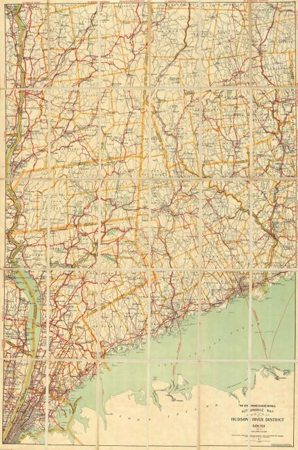
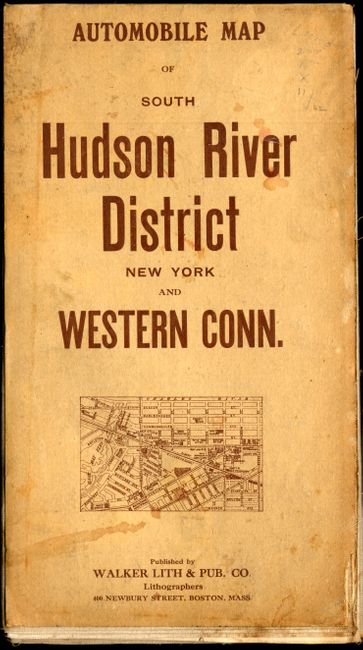
"The Automobile Club of America. Automobile Map of Hudson River District South No. 6",

Subject: New York

Period: 1908 (dated)

Publication:

Color: Printed Color

Size:
42 x 28.8 inches
106.7 x 73.2 cm
Download High Resolution Image
(or just click on image to launch the Zoom viewer)

This is an early automobile road map, dissected into 18 sections and backed on linen. This colorful pocket map shows New York City at the bottom left and extends north along the Hudson River to Kingston and as far east as Winsted, Waterbury and Milford. The map details the routes and roads throughout the area that includes the cities of Ansonia, Bridgeport, Norwalk, Danbury, as well all of the towns and villages along the Hudson. Very good detail throughout on a scale of 2 miles to the inch. The legend uses color and pattern to delineate three road types: Good Automobile Routes, State Roads, and other Routes. Considering that the American Automobile Association did not issue it's first map until 1905, this map, with it's earliest copyright date of 1903, is a very early automobile map. It folds into printed covers titled "Automobile Map of South Hudson River District New York and Western Conn." A paper label pasted on the linen records the company's return policy, "This Book is Not Returnable or Subject to Exchange. Brentano's."

References:

Condition: A

The map is sound and folds nicely into the paper covers. The paper covers are a little soiled.

Estimate: $150 - $200

Sold for: $75

Closed on 12/6/2006

Archived