Catalog Archive
Auction 117, Lot 25

"The World on Mercator's Projection", SDUK Society for the Diffusion of Useful Knowledge
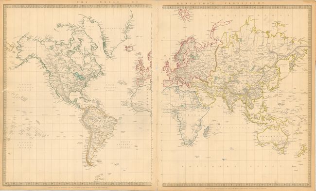
Subject: World

Period: 1841 (dated)

Publication:

Color: Hand Color

Size:
26 x 15.5 inches
66 x 39.4 cm
Download High Resolution Image
(or just click on image to launch the Zoom viewer)

This delicately detailed map on two separate sheets presents a considerable amount of information. The United States is shown excluding the Southwest and Texas. Texas was an independent country from 1836-1845, but it is shown here as part of Mexico. The northern border of the United States and Canada shows the disputed border for Oregon Territory coming down to about the 45th parallel, which reflects British claims in that region. This was finally solved in 1846 with the Oregon Treaty fixing that border at the 49th parallel. The Arctic region shows the extent of contemporary knowledge, noting nothing besides Packed Ice north of the Bering Strait. Africa is shown with much of its interior left unmapped - that region was not mapped thoroughly until the latter part of the 19th century. An attractive an informative map surrounded with a keyboard style border. Size shown is for both sheets, as if they were joined.

References:

Condition: A

Very nice color and impression with minor toning in margins. Sheets are lightly bound together.

Estimate: $110 - $130

Sold for: $140

Closed on 12/6/2006

Archived