Catalog Archive
Auction 117, Lot 232

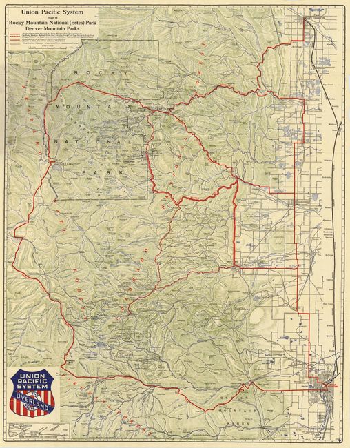
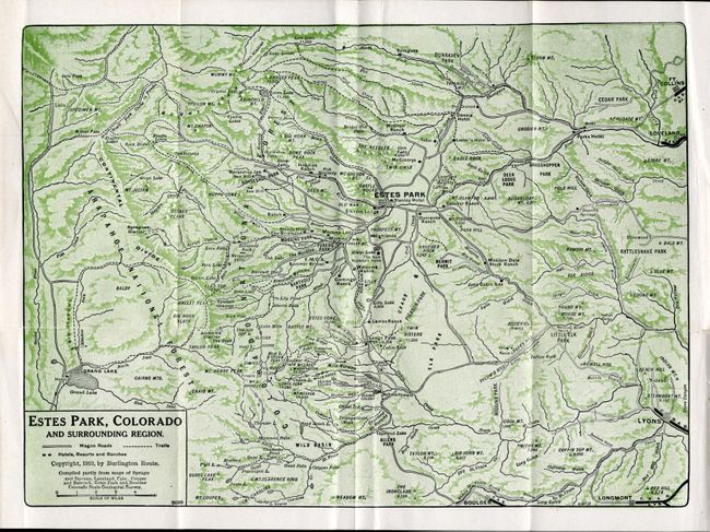
"[Lot of 2] Union Pacific System Map of Rocky Mountain National (Estes) Park Denver Mountain Parks [and] Estes Park, Colorado and Surrounding Region",

Subject: Colorado

Period: 1910-26 (dated)

Publication:

Color: Printed Color

Size:
See Description
Download High Resolution Image
(or just click on image to launch the Zoom viewer)

Terrific pair of pocket maps showing the tourist areas of Colorado. The first is a handsome topographical map of the Rocky Mountains west of and between Denver and Fort Collins. Details the entire Rocky Mountain National Park, plus the Colorado, Arapaho, and Pike National Forests. Good detail of the cites with streets in grid layout format. Locates Idaho Springs, Golden, Central City, Tolland, Eldora, Nederland, Magnolia, Peaceful Valley, Grand Lake, and Estes Park. Folds into pictorial wrappers featuring the state flower, the Colorado Columbine. On the back cover is an extensive list of Union Pacific Representatives. 8 pp index. 1926. (24 x 30.8")
The second map folds into printed wrappers titled "Vest-Pocket Map of Estes Park." The original publisher (W. T. Parke) and price (5 cents) are crossed out with "Free" hand-written above and "Baird's Estes Park, Colo" stamped above the publisher's imprint. This map extends from Grand Lake to Loveland and Fort Collins in the northeast and Longmont at lower right. Filled with topographical and watershed detail with many lakes located and named. On verso, helpful information includes the park's hotels, mountains, lakes, scenic drives and a few marketing slogans like "Don't forget that we carry a full line of Fishing Tackle." 1910. (11 x 8")

References:

Condition: A

The first map is very nice; the covers with a little light soiling. The second map is fine, with some loss of text on rear cover where it was pasted into scrapbook.

Estimate: $120 - $160

Sold for: $60

Closed on 12/6/2006

Archived