Catalog Archive
Auction 117, Lot 21

"Carte Generale du Monde, ou Description du Monde Terrestre & Aquatique", Covens & Mortier
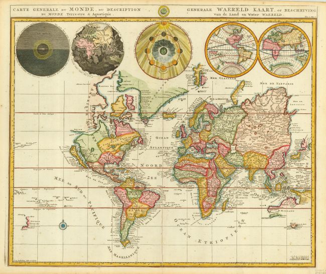
Subject: World

Period: 1730 (circa)

Publication:

Color: Hand Color

Size:
18.5 x 15 inches
47 x 38.1 cm
Download High Resolution Image
(or just click on image to launch the Zoom viewer)

Pierre Mortier's unique world map drawn on Mercator's projection with California as an island and the Detroit d'Anian connected by dotted lines through the Northwest Passage to Button's Bay located to the west of Hudson Bay. There is an erroneous large lake shown as the source for the Rio Norte located in the Southwest, as well as an early, open-ended version of the Great Lakes named Mer Douce. A small coastline of New Zealand appears in the Pacific. The northeast coast of Asia is severely truncated and shows Witsen's Cap de Glaces. Australia's northern coast is shown connected to New Guinea, and two disjointed coastlines appear to the south including Van Diemen's Land. The most interesting features of the map are the five spheres presented along the top. These depict Day and Night, the Flood, the phases of the moon, and the Western and Eastern Hemispheres. The map was precisely engraved by Jan van Luchenburg (signature at lower left). This is the second state with the Covens and Mortier imprint.

References: Shirley #622.

Condition: A

A few very insignificant spots, still very good with a crisp impression and fine later color. Full, original margins.

Estimate: $1,500 - $1,700

Unsold

Closed on 12/6/2006

Archived