Catalog Archive
Auction 117, Lot 205

"No. 5 That Part of Disturnell's Treaty Map in the Vicinity of the Rio Grande and Southern Boundary of New Mexico…", U.S. Government

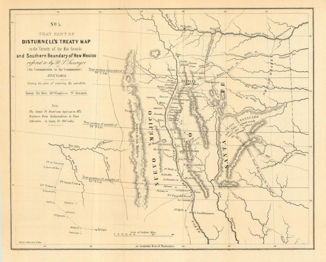
Subject: Southwestern United States

Period: 1851 (dated)

Publication: Sen. Ex. Doc., 32nd Cong., 2nd Sess.

Color: Black & White

Size:
10.7 x 8.5 inches
27.2 x 21.6 cm
Download High Resolution Image
(or just click on image to launch the Zoom viewer)

This is a fascinating map centered roughly on Santa Fe. The map covers the area from the Arkansas River south to the 31st parallel and locates Albuquerque and Tucson. The parallels were being corrected from an incorrect position previously mapped, and this map illustrates both old and new parallels. Shows topography, hydrology, Gen. Kearny's route, the route of the Santa Fe Expedition, the old Spanish military road, among other interesting items. It was one of the key maps in the Bartlett correspondence regarding the dispute over the survey of the Mexican border.

References: Koepp CIS 626, map #4; Wheat (TMW) 720.

Condition: B+

Light, even toning with a short fold separation and tear on the left just touching neatline, closed on verso. Near fine, with folds as issued and some archival tape on the verso reinforcing a fold split.

Estimate: $140 - $160

Unsold

Closed on 12/6/2006

Archived