Catalog Archive
Auction 117, Lot 162

"Florida calle'd by ye French Louisiana &c.", Moll, Herman

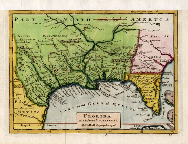
Subject: Colonial Southern United States

Period: 1728 (dated)

Publication: Atlas Minor

Color: Hand Color

Size:
10.5 x 7.8 inches
26.7 x 19.8 cm
Download High Resolution Image
(or just click on image to launch the Zoom viewer)

This map is based on Moll's larger map of 1720 and portrays the Gulf Coast and Florida with detail of Indian villages, missions, mines and forts. It is one of the earliest printed maps to describe the roads and trading paths in the region. It is also filled with interesting notations including notes on La Salle's landing in Texas in 1685, the Cenis Missions and early Texas settlements in 1716-17, and the limits of King Charles II's Grant to the Lord Proprietors (Carolina) in 1663. This is the first state with the erroneous apostrophe in calle'd in the title.

References: Cumming (SE) #201.

Condition: A

Nice impression and attractive later color. Remargined at top with slightly lighter toned paper.

Estimate: $700 - $800

Sold for: $600

Closed on 12/6/2006

Archived