Catalog Archive
Auction 117, Lot 154

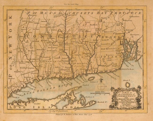
"A Map of the Colonies of Connecticut and Rhode Island, Divided into Counties & Townships, from the best Authorities", Kitchin, Thomas
Subject: Colonial New England

Period: 1758 (dated)

Publication: London Magazine

Color: Hand Color

Size:
9 x 7 inches
22.9 x 17.8 cm
Download High Resolution Image
(or just click on image to launch the Zoom viewer)

This is the first printed map to depict primarily these two colonies. It details the towns and villages, roads and rivers throughout. The township designations are not found on any other maps. Kitchin probably used the survey of Gardner and Kellock (1737) as the source for this map. This finely engraved copper plate map is drawn on a scale of approximately 16 miles to the inch. It is embellished with a decorative title cartouche, distance scale and simple compass rose.

References: Jolly LOND-135 and Thompson #14.

Condition: C

Good impression on thick hand laid paper, but toned and with an area of heavier toning at center. This is a sound map on stable paper that would benefit from cleaning.

Estimate: $180 - $220

Sold for: $160

Closed on 12/6/2006

Archived