Catalog Archive
Auction 117, Lot 144

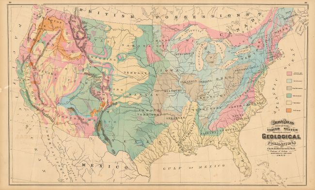
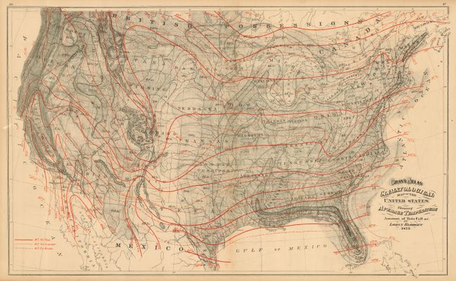
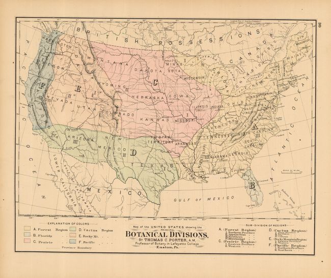
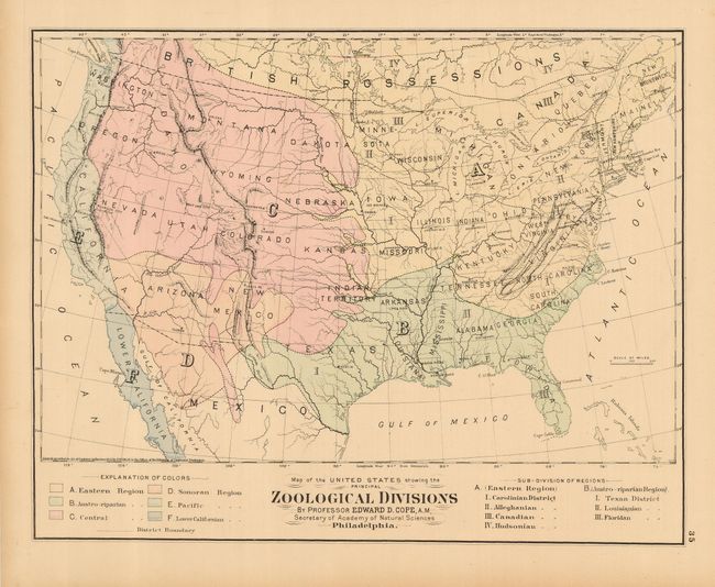
"[Lot of 4 - Theamatic Maps]", Gray, Frank

Subject: United States

Period: 1873 (published)

Publication: Gray's Atlas of the United States

Color: Hand Color

Size:
See Description
Download High Resolution Image
(or just click on image to launch the Zoom viewer)

Nice lot of thematic maps of the United States.

1) Map of the United States Showing the Principal Geological Formations. This double-page sheet is an unusual map that indicates six different geological formations in vivid hand coloring. The map was drawn, as the credit indicates, by Charles H. Hitchcock, professor of geology at Dartmouth College. Oklahoma is Indian Territory, and there is one Dakota. Major mountains, cities, and rivers are located, and only a few major cities are shown. Text on verso relates to map and is by Hitchcock. (26.3 x 16")
2) Climatological Map of the United States Showing Average Temperature Amount of Rain Fall &c. Double-page sheet with the fine texture of a stone lithograph. Text on verso by Lorin Blodget. (26 x 16")
3) Map of the United States Showing the Botanical Divisions. Map and text on verso by Thomas C. Porter. (15 x 11.8")
4) Map of the United States Showing the Zoological Divisions. Map and text on verso by Edward D. Cope. (15 x 11.8")

References:

Condition: B

All with good color and impression and full, original margins. Some occasional very light foxing or offsetting.

Estimate: $150 - $250

Sold for: $160

Closed on 12/6/2006

Archived