Catalog Archive
Auction 117, Lot 140

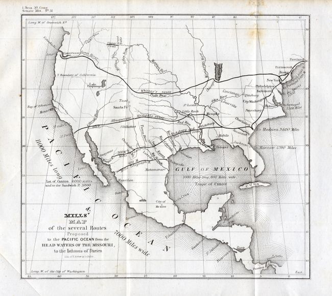
"Mills' Map of the several Routes Proposed to the Pacific Ocean from the Head Waters of the Missouri, to the Isthmus of Darien", U.S. Government

Subject: United States

Period: 1848 (published)

Publication: Sen. Doc. #51, 1 Sess. 30th Cong.

Color: Black & White

Size:
9 x 8.3 inches
22.9 x 21.1 cm
Download High Resolution Image
(or just click on image to launch the Zoom viewer)

This interesting and historically important map was one of the first to promote to Congress the idea of a trans-continental railroad. The map shows four major routes; Whitney's route (connecting New York, Chicago and Astoria), the Albuquerque-Memphis route (connecting Memphis, Little Rock, Albuquerque and San Diego), the Vicksburg and New Orleans route (from New Orleans to Vicksburg and on to San Antonio and Guaymas) and finally the Mills Telegraph Route (cutting across Texas and Mexico from Matagorda to an unnamed terminal in the vicinity of Los Mochis). Robert Mills proposed linking the two coasts by rail as early as 1819 and was among the project's most ardent supporters.

References: Wheat (Gold) #54; Wheat (TMW) #564.

Condition: B

A sound example on thick paper that is folding, as issued. Foxing stain at upper right in blank area just beneath border, otherwise very good.

Estimate: $140 - $200

Sold for: $100

Closed on 12/6/2006

Archived