Catalog Archive
Auction 117, Lot 131

"Map of the Oregon Territory from the Best Authorities", Wilkes, Charles

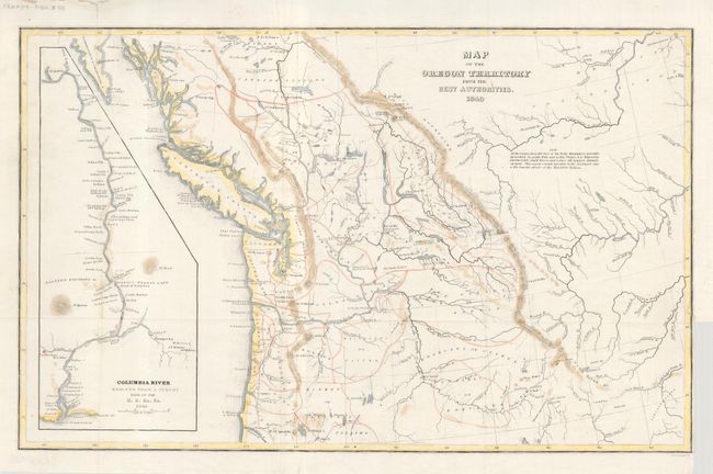
Subject: Northwestern United States and Canada

Period: 1849 (dated)

Publication: Western America; including California and Oregon…

Color: Hand Color

Size:
13 x 8 inches
33 x 20.3 cm
Download High Resolution Image
(or just click on image to launch the Zoom viewer)

This is a reduced edition of Wilkes' map that was a major contribution to American cartography and the most detailed map of the region north of the Sacramento River. It provided Americans with an accurate view of an area still virtually unknown in the mid nineteenth century. Wilkes supported the view of Senator Lewis Linn that the northwest boundary of America should be 54 deg. 40' North, the famous 54-40 or Fight controversy. This map was used to support his claim that was based on 'topographical' grounds and was instrumental in setting the scene for American interests in the territory. The map covers the region from Fraser's Fort and Fort St. James in British Columbia south to the upper Sacramento River, and from the Pacific coast to the Black Hills east of the Rocky Mountains. The map provides excellent detail of the region including dozens of forts, watershed, and other place names. A large inset map "Columbia River Reduced from a survey made by the U.S. ex. Ex. 1841" depicts the river from Ft. Walla Walla to its mouth, where one of Wilkes' ships, the Peacock, was lost on the infamous Columbia Bar. It includes details of missions, Indian villages, and the major mountains with north oriented to the left.

References: Wheat (TMW) #655; Hayes 199.

Condition: B

Map image with light hand coloring and some cockling to paper, else very good. Binding trim at lower right and a little roughness to margin at upper left.

Estimate: $250 - $300

Sold for: $180

Closed on 12/6/2006

Archived