Catalog Archive
Auction 117, Lot 117

"Nieuwe Kaart van de Grootbrittannische Volkplantingen in Noord America", Tirion, Isaac

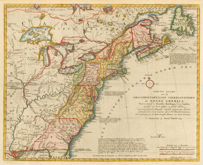
Subject: Colonial United States and Canada

Period: 1755 (dated)

Publication:

Color: Hand Color

Size:
18 x 14.3 inches
45.7 x 36.3 cm
Download High Resolution Image
(or just click on image to launch the Zoom viewer)

A great map illustrating the region at the beginning of the French and Indian War. It is a very detailed map of the British and French possessions and the disputed region between the Mississippi River and the Appalachian and Allegheny Mountains. The frontier forts of both nations are located, as are colonial settlements and Indian villages. A small compass rose is the only ornamentation. The map was based on information from John Mitchell's great map of North America. Although this map bears the date 1755, it apparently was not published until 1769.

References: McCorkle #755.39 &769.1; Sellers and Van Ee #63.

Condition: A+

Issued folding, now pressed.

Estimate: $800 - $900

Sold for: $600

Closed on 12/6/2006

Archived