Catalog Archive
Auction 116, Lot 99

"North America", Johnston, Alexander K.

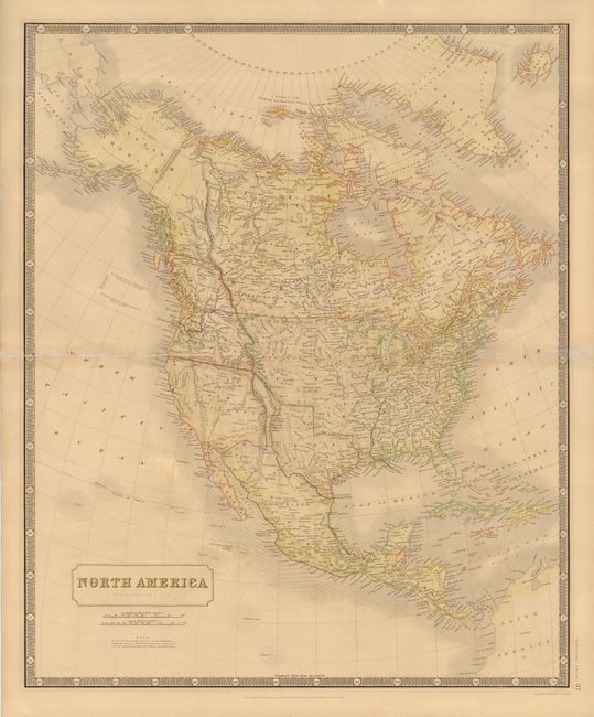
Subject: North America

Period: 1844 (circa)

Publication: National Atlas

Color: Hand Color

Size:
19.5 x 23.8 inches
49.5 x 60.5 cm
Download High Resolution Image
(or just click on image to launch the Zoom viewer)

This interesting map of North America shows much of the West in transition. Upper or New California takes up most of the Southwest of the United States, with a narrow finger of Mexico squeezed in between California and the independent Republic of Texas. Above California is the Oregon Territory and Columbia with a notation below the title stating "The whole of the territory, to the west of the Rocky Mountains, between the Mexican & the Russian boundaries, or between 42° & 54° 40' N. Lat. is claimed by both Gt. Britain and the United States." The map provides good detail for a map of this scale, particularly of the river systems.

References:

Condition: B

Attractive original color. Repairs to centerfold and some minor soil.

Estimate: $275 - $325

Sold for: $200

Closed on 9/20/2006

Archived