Catalog Archive
Auction 116, Lot 93

"A New Map of North America According to the Newest Observations", Moll, Herman

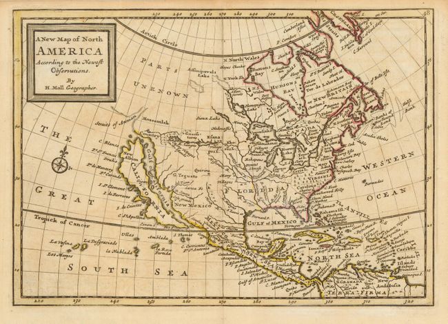
Subject: North America

Period: 1745 (published)

Publication: Osborne's A Collection of Voyages & Travels

Color: Hand Color

Size:
10 x 7 inches
25.4 x 17.8 cm
Download High Resolution Image
(or just click on image to launch the Zoom viewer)

Attractive small map of North America that extends to include the West Indies and northern South America. The island of California dominates the west coast with the Straits of Anian, Mozeemlek Country and Parts Unknown shown above the island. The British Colonies are confined to the eastern seaboard and Florida occupies all of the present southern United States. Lake Superior is simply named Upper Lake. Lahontan's mythical Longue River stretches between two lakes in the west, with a notation of "Many villages on the islands" in the most western lake. A decorative compass rose fills the Great South Sea.

References: McLaughlin #225.

Condition: A

Bit of faint offsetting, still overall very good with a sharp impression and original outline color.

Estimate: $750 - $850

Sold for: $700

Closed on 9/20/2006

Archived