Catalog Archive
Auction 116, Lot 889

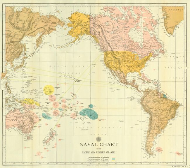
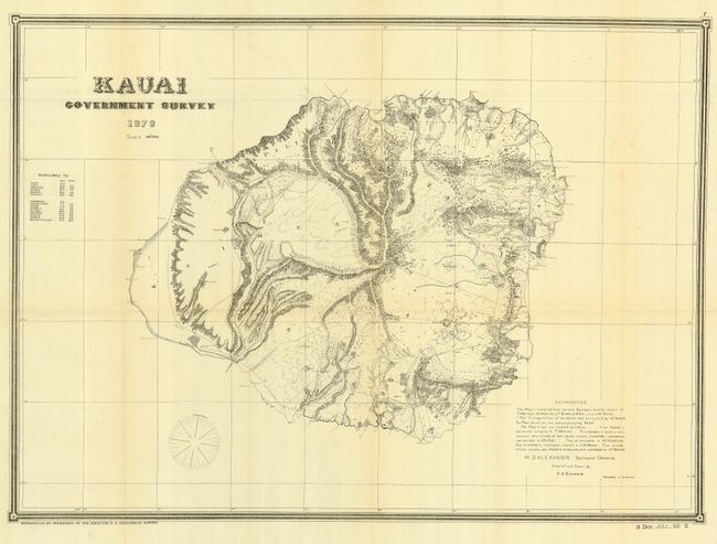
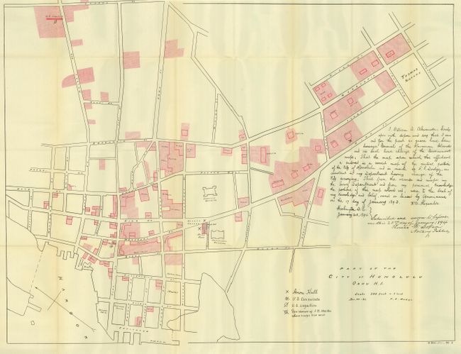
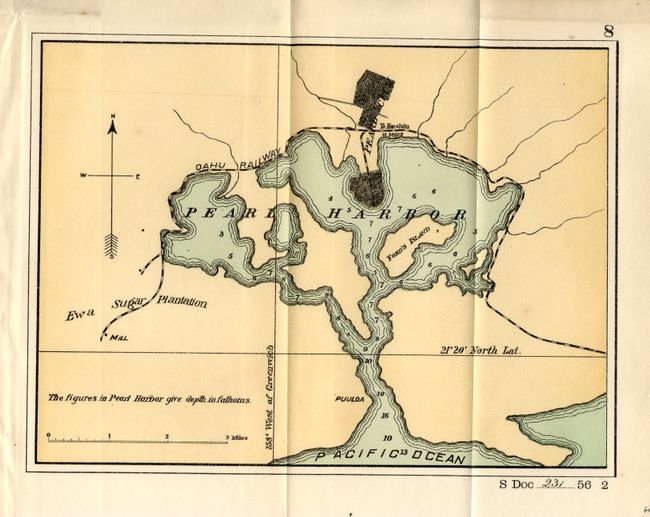
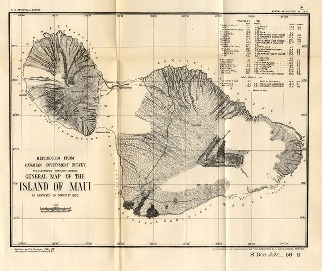
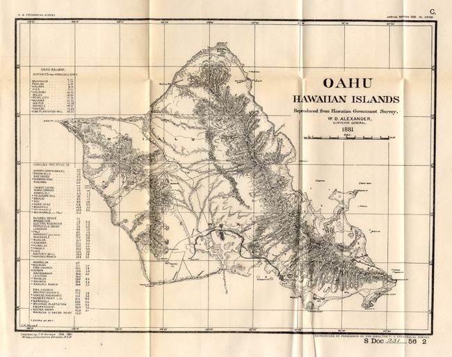
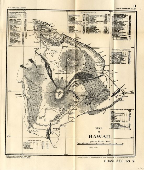
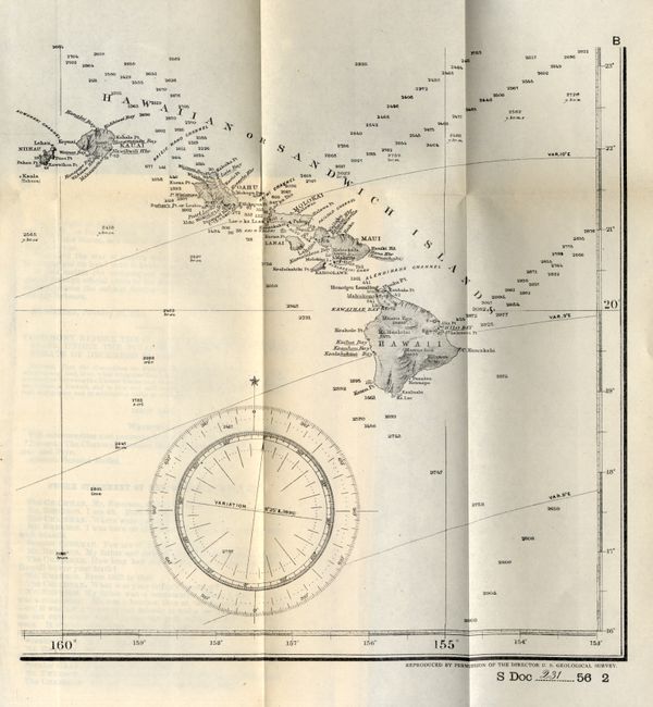
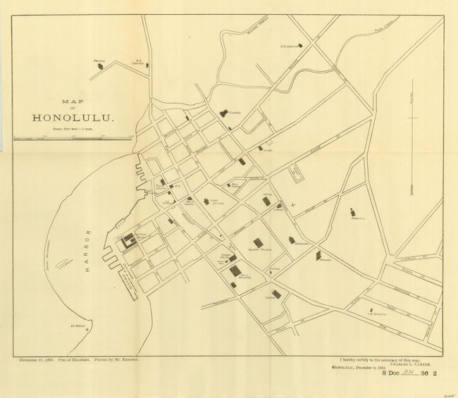
"Diplomatic Relations with Foreign Nations [Hawaii]", U.S. Government

Subject: History, Hawaii

Period: 1901 (published)

Publication: Senate doc. 231, 56th Cong., 2nd Sess.

Color: Printed Color

Size:
6 x 9.3 inches
15.2 x 23.6 cm
Download High Resolution Image
(or just click on image to launch the Zoom viewer)

This book discuses the relations between the United States and Hawaii, with ten folding maps including plans of Honolulu. While the document contains several reports on Foreign Relations, the main report (pp. 363-1169) pulls together notable documents on the history of the Hawaiian Islands, their physical features and the events that took place during the political revolution of 1893 in Hawaii that led, eventually, to annexation of the Hawaiian Islands. It should be useful to any student of the history of the islands. Hardbound in brown calf, red, tan and black leather gilt labels on spine, 1176pp. Maps include:

1) [untitled] Hawaiian or Sandwich Islands, 10 x 10"
2) Naval Chart of the Pacific and Western Atlantic, 25 x 22", noted colonial ownership for England, France & Germany.
3) [untitled] Plan of Pearl Harbor, 9.8 x 7.3"
4) Map of Honolulu, 14.2 x 11.5", great plan with named streets and many buildings located.
5) General Map of the Island of Maui, 11.3 x 9", with table giving distances around the island between numerous places and important buildings.
6) Oahu Hawaiian Islands, 12.5 x 9.5"
7) Map of Hawaii, 8 x 9"
8) Kauai Government Survey 1878, 25 x 18"
9) Part of the City of Honolulu Oahu H.I., 34.3 x 24.5"
10) a duplicate copy of Map of Honolulu, 14.2 x 11.5".

References:

Condition: A

Contents and maps are very good to fine, but binding is rough. Back board detached, front starting with spine splits, binding rubbed and worn, spine nearly detached. Most maps are cleanly detached, but all are in very good to fine condition.

Estimate: $250 - $350

Sold for: $210

Closed on 9/20/2006

Archived