Catalog Archive
Auction 116, Lot 82

"Carte d'Amerique, Dressee pour l'Usage du Roy…", Delisle/Covens & Mortier

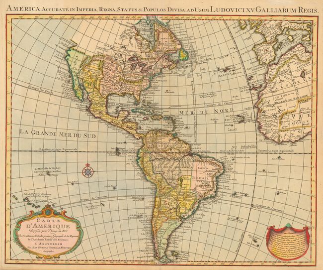
Subject: Western Hemisphere

Period: 1739 (dated)

Publication:

Color: Hand Color

Size:
23.5 x 19.5 inches
59.7 x 49.5 cm
Download High Resolution Image
(or just click on image to launch the Zoom viewer)

This map, first issued by Delisle in 1722, was one of the most popular maps of the 18th Century. This is the fourth state published in Amsterdam by Covens & Mortier with the addition of a Latin title at top; America Accurate in Imperia, Regna, Status & Populos Divisa. The detailed map of the Americas provides a great deal of information about the state of geographic knowledge in the New World in the early part of the century. The French territory of Louisiane takes up the lion's share of North America at the expense of the British colonies. This political bias is due to Delisle's position as geographer to the King of France.

References: Tooley (Amer) p. 13, #4, plt. 2.

Condition: A

Small, old repair of fold in bottom margin and a couple of very insignificant light spots, else near fine.

Estimate: $900 - $1,000

Sold for: $700

Closed on 9/20/2006

Archived