Catalog Archive
Auction 116, Lot 797

"Africa Lybia Moerenlandt mit allen Konigreichen…", Munster, Sebastian
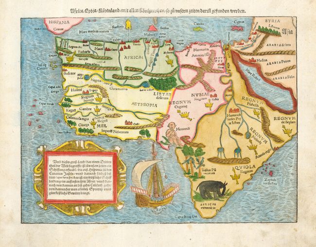
Subject: Africa

Period: 1550 (circa)

Publication:

Color: Hand Color

Size:
13.5 x 10 inches
34.3 x 25.4 cm
Download High Resolution Image
(or just click on image to launch the Zoom viewer)

This is one of the first modern maps of the whole continent. The Ptolemaic geography, with large rivers and convoluted mountains, is augmented from Portuguese and Arabic sources. From the Portuguese comes Caput Bonespei (Cape of Good Hope) and a small group of islands off the eastern coast named Zaphala Aurifodina that were supposedly the region from which King Solomon imported gold and silver. The Arab kingdoms of Quiola and Melinde appear in eastern Africa and Hamarich, the capital of the mythical Christian king Pester John, is shown at the confluence of the twin sources of the Nile. The map is illustrated with crowns and scepters, forests, parrots, an elephant, a Cyclops (Monoculi) and a large galleon under full sail. The strapwork cartouche containing a text description of the continent. The German title is above the map.

References: Tooley (AF) #9; Norwich #2.

Condition: A

Light soil in margins.

Estimate: $1,100 - $1,500

Sold for: $1,200

Closed on 9/20/2006

Archived