Catalog Archive
Auction 116, Lot 761

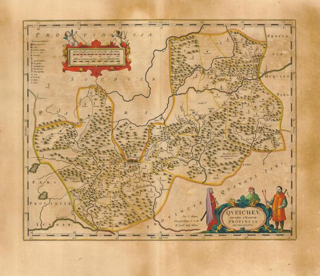
"Queicheu. Imperii Sinarum Provincia Decimaquarta", Blaeu, Johannes

Subject: China

Period: 1655 (circa)

Publication: Novus Atlas Sinensis

Color: Hand Color

Size:
19.3 x 15.5 inches
49 x 39.4 cm
Download High Resolution Image
(or just click on image to launch the Zoom viewer)

The second landmark in the European mapping of China was the appearance of the Novus Atlas Sinensis in 1655. It was compiled by Father Martino Martini, an Italian Jesuit and produced by the most prominent Dutch cartographer of the time, Johannes Blaeu. Father Martini compiled the work based on Chinese sources between 1643 and 1650, and it greatly advanced European knowledge of the region including the astronomical positions of many cities and topographical features. It remained the standard geographical work on that country until the publication in 1737 of D'Anville's Atlas de la Chine. This map of the Kuei-chou Province is decorated with two fine cartouches featuring putti and Chinese men showing the native costume of the region.

References:

Condition: B

Fine impression and original color. Uneven toning, darker in margins. Some tears in margins, none close to map.

Estimate: $375 - $475

Sold for: $375

Closed on 9/20/2006

Archived