Catalog Archive
Auction 116, Lot 678

"Bysondere Kaart Vande Vier Groote Monarchien, van Assyrien, Persie, Griekenland, en die der Romeinen", Mortier, Pierre

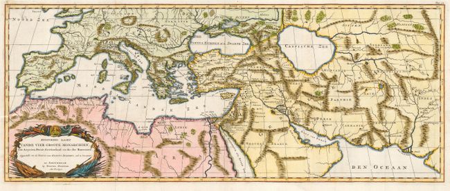
Subject: Roman Empire

Period: 1700 (circa)

Publication:

Color: Hand Color

Size:
28 x 11.3 inches
71.1 x 28.7 cm
Download High Resolution Image
(or just click on image to launch the Zoom viewer)

This uncommon chart of the Roman Empire covers all the Mediterranean and extends into Asia as far as the Indus River. It illustrates the region as described in Flavius Josephus’ history of the Jewish War from AD 66-73. The map is decorated with a military-themed title cartouche. On two joined sheets, as issued.

References:

Condition: B

Issued folding and now pressed. Small stain at upper left and an old paper repair of a short binding tear at lower left.

Estimate: $150 - $200

Sold for: $110

Closed on 9/20/2006

Archived