Catalog Archive
Auction 116, Lot 611

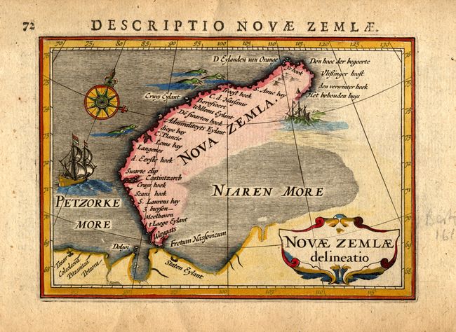
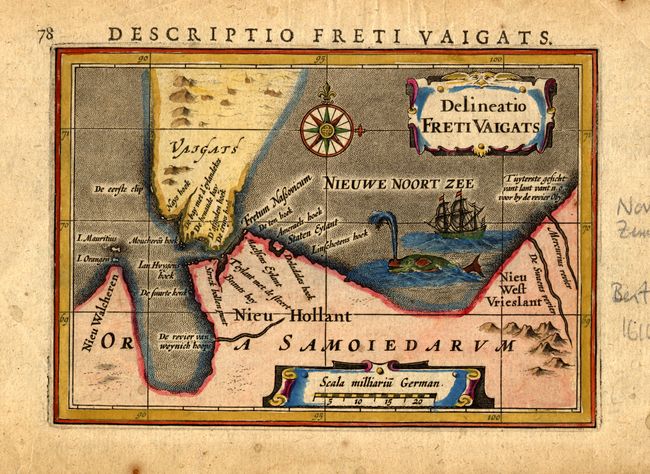
"[Lot of 2] Novae Zemlae delineatio [and] Delineatio Freti Vaigats", Bertius, Petrus

Subject: Russia

Period: 1616 (published)

Publication:

Color: Hand Color

Size:
5.3 x 3.7 inches
13.5 x 9.4 cm
Download High Resolution Image
(or just click on image to launch the Zoom viewer)

This pair of miniature maps shows the parts of Novaya Zemlya that had been discovered by western Europeans during their search a northern passage to Asia. The first visit was by Hugh Willoughby in 1553. Then in 1596, Willem Barents rounded the north point of Novaya Zemlya, and wintered on the east coast near the northern tip. The first map shows the western coast and northern tip of Noyaya Zemlya according to Barent's reports. The second map shows the straight separating Vaygach Island from the mainland. At the time Vaygach Island was thought to be a part of Novaya Zemlya. The maps are decorated with a sailing ships, compass roses, sea life, and nice title cartouches.

References:

Condition: A

Pencil notations and a few spots in blank margins.

Estimate: $220 - $275

Sold for: $160

Closed on 9/20/2006

Archived