Catalog Archive
Auction 116, Lot 435

"Northumbriae Comitatus, olim sedes Otadinorum", Saxton/Hole
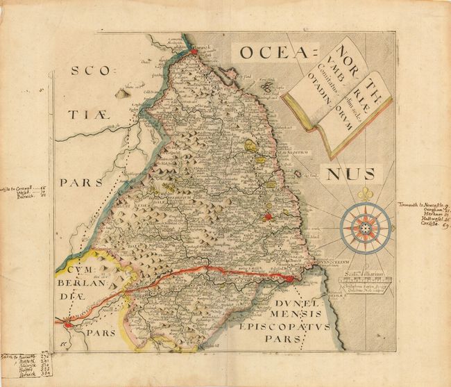
Subject: England

Period: 1637 (circa)

Publication: Camden's Britannia

Color: Hand Color

Size:
11.5 x 10.7 inches
29.2 x 27.2 cm
Download High Resolution Image
(or just click on image to launch the Zoom viewer)

This handsome chart of Northumbria is filled with place names and other details. Hadrian's Wall, here called The wall of the piets is highlighted in red. The title is contained in an interesting cartouche fashioned like an open book. Map is embellished with a large compass rose with fleur-de-lys and rhumb lines, and a distance scale with the imprint of Saxton and Hole below. There is evidence of a damaged plate with top left corner lacking neat lines. Blank verso. A previous owner has noted in the margin major cities with the distances from Carlise, London and Tinmouth. A corresponding dotted line indicates the roads on the map.

References:

Condition: B

Good impression with full, wide margins and large coat of arm watermark. Light damps stains in margins. Remnants of paper hinges on verso.

Estimate: $200 - $250

Sold for: $150

Closed on 9/20/2006

Archived