Catalog Archive
Auction 116, Lot 348

"General Map Showing the Countries Explored & Surveyed by the United States & Mexican Boundary Commission in the Years 1850, 51, 52 & 53", Bartlett, John Russell

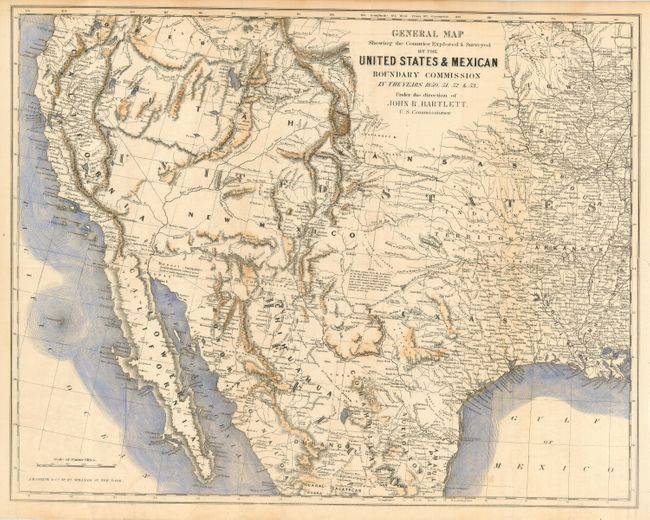
Subject: United States & Mexico

Period: 1854 (published)

Publication: Personal Narrative of Explorations…

Color: Hand Color

Size:
19 x 15.2 inches
48.3 x 38.6 cm
Download High Resolution Image
(or just click on image to launch the Zoom viewer)

This map covers the entire West from the Mississippi River with particular emphasis on the land recently obtained from Mexico and is filled with place names, numerous Indian villages, geographical notes and more. Wheat notes this is, all in all, an excellent map of the West that has a very early depiction of the Gadsden Purchase. It is one of the first commercial maps to show Jackson Lake east of the three Tetons, here named Sublettes L. The geography of the unnamed Great Basin follows closely the cartography of Fremont's maps of 1845 and 1848. Utah is in its largest configuration stretching between California and east beyond the Continental Divide to Kansas. Place names include Mormon Sett. in Utah, Franklin is opposite of El Paso and numerous New Mexican settlements. The routes of numerous explorers are identified. The map extends to include all of the Baja. Published by J.H. Colton & Co.

References: Wheat (TMW) #798; Wagner-Camp #234:1.

Condition: B

With modern hand coloring. Hint of toning along one fold, two short marginal tears closed on verso, else very good.

Estimate: $250 - $350

Sold for: $650

Closed on 9/20/2006

Archived