Catalog Archive
Auction 116, Lot 330

"Railway and Highway Map of the Famous Berkshire Hills Region, Showing also Villages and Points of Interest…", Watson, C.E, Walter

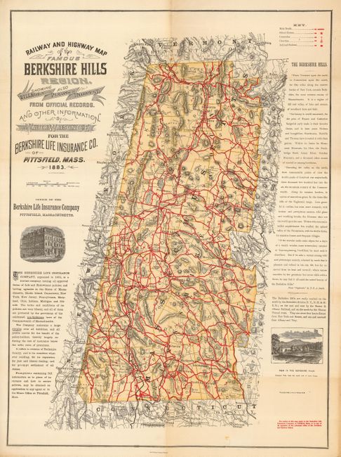
Subject: Massachusetts

Period: 1883 (dated)

Publication:

Color: Printed Color

Size:
22 x 30 inches
55.9 x 76.2 cm
Download High Resolution Image
(or just click on image to launch the Zoom viewer)

This is a noteworthy and seldom seen map published by Walter Watson for the Berkshire Life Insurance Company, Pittsfield, Mass. The map lays out the railways and highways of the Berkshire Hills region in 1883 in remarkable detail. A legend identifies main roads, school houses, cemeteries, churches, railroad stations, and much, much more. The Berkshire Hills are described at right in a long excerpt from "Taghconic," by F.E.A. Smith. A vignette shows the company's headquarters building and another "View of the Berkshire Hills. Greylock Peak from the south end of Lake Onota." According to the Harvard University Gazette, Oct. 24, 2002, this map is widely regarded as the first 'free' road map ever distributed mainly for use by touring bicyclists. A nice example that shows more finely than the condition description may suggest.

References:

Condition: B

Folding, as issued, with original color and full margins. Some marginal roughness with chipping at right margin, hint of toning along one fold in blank areas, one small tape mark near bottom, else very good.

Estimate: $375 - $425

Sold for: $275

Closed on 9/20/2006

Archived