Catalog Archive
Auction 116, Lot 302

"[Lot of 2] Indian Territory [and] Tunison's Oklahoma and Indian Ters.",
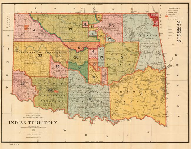
Subject: Oklahoma

Period: 1885-1902

Publication:

Color: Printed Color

Size:
See Description
Download High Resolution Image
(or just click on image to launch the Zoom viewer)

1) Indian Territory General Land Office, 1885 (32.3 x 24") This interesting and detailed map reflects the status of lands allocated to various tribes (color coded). Indian removals from 'home lands' began as early as 1817 and in the years following, many of the principal Eastern Indian tribes were relocated to the region with the "Five Civilized Tribes" having formed the nucleus of an organized government. By 1885, however, representatives of some fifty tribes had settled on lands once promised to the original five. This map reflects many of these allocations and provides some data on the pertinent treaties involved. Does not include the panhandle, which by this time are "Public Lands." Drawn by G. P. Strum and made under the direction of N.C. McFarland, Commissioner. Folding, as issued. A little offsetting visible in blank area below map. Some loss in left border with paper replaced include a small area of facsimiled neatline.
2) Tunison's Oklahoma and Indian Ters., H.C. Tunison, [1902] (20 x 13.5") This is a great map showing the territories just prior to statehood. A map of East Texas is on verso.

References:

Condition:

First good, second fine.

Estimate: $200 - $300

Sold for: $200

Closed on 9/20/2006

Archived